Forecast for the Skyline Area Mountains

Brett Kobernik
Issued by Brett Kobernik on
Sunday morning, January 2, 2022
TODAY IS ANOTHER LIKELY DAY FOR AN AVALANCHE ACCIDENT. THE COMBINATION OF SUNNY WEATHER AND EXCELLENT RIDING CONDITIONS WILL LURE PEOPLE INTO AREAS WITH DANGEROUS AVALANCHE CONDITIONS.
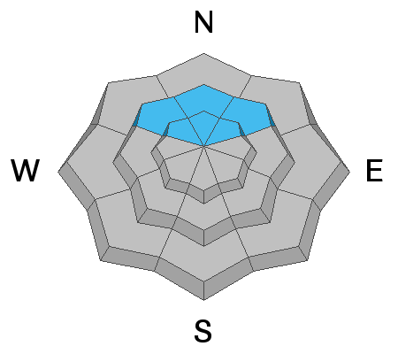
The avalanche danger remains HIGH today. Continue to avoid all avalanche terrain on the north side of the compass.
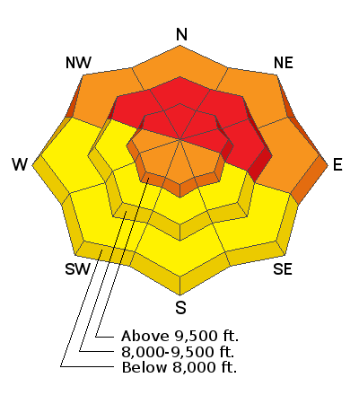
Low
Moderate
Considerable
High
Extreme
Learn how to read the forecast here
Avalanche Warning
AN AVALANCHE WARNING HAS BEEN ISSUED FOR THE MOUNTAINS INCLUDING THE MANTI-SKYLINE ...THE FISH LAKE REGION…PAHVANTS…TUSHARS…AND THE CEDAR CITY AREA MOUNTAINS.
THE AVALANCHE DANGER IS HIGH FOR THE WARNING AREA AND TRAVEL IN AVALANCHE TERRAIN IS NOT RECOMMENDED.
HEAVY SNOWFALL AND STRONG WINDS HAVE CREATED DANGEROUS AVALANCHE CONDITIONS. BEING CAUGHT IN ANY AVALANCHE IS LIKELY TO BE UNSURVIVABLE. STAY OFF OF AND OUT FROM UNDER SLOPES STEEPER THAN 30 DEGREES.
Weather and Snow
Current Conditions
Every report that I've heard from the backcountry includes how outstanding the riding conditions are right now. The snow is really about perfect for deep powder hounds. Temperatures have rebounded up into the low teens after dipping well below zero last night. The wind has really died off and is almost calm.
Mountain Weather
We're going to see a spectacular sunny day today with highs up into the 20s and light wind. Monday looks mostly clear with clouds moving in late in the day. The next small storm system looks like it'll move in on Wednesday bringing a few inches of new snow.
Recent Avalanches
There was a report of a near miss in the Gooseberry zone of the Fish Lake mountains. A rider was testing his new turbo on a steep northeast facing slope when it avalanched. The avalanche was reported as 900 feet wide and 8 feet deep at the deepest part of the fracture. He was able to ride the flowing debris for a while before getting thrown. He was pinned against a tree and ended up only half buried. This is the textbook example of what I've been concerned about with our current snowpack conditions. This rider almost lost his life. It was as close as it gets.
Ad
Avalanche Problem #1
Persistent Weak Layer
Type
Location
Likelihood
Size
Description
Triggering a large slab avalanche that breaks into weak sugary snow near the base of the snowpack is your biggest concern again today. This is most likely at mid and upper elevations on steep northwest, north and northeast facing slopes.
Obvious signs of avalanche danger are mostly absent right now. You may not see any recent avalanches. The snowpack is stubborn now and you probably won't experience any collapsing or WHUMPFING of the snowpack.
All the new snow since Christmas is settling. I've seen up to 10" of settlement in the last two days at one of the weather stations on the Skyline. This settlement is what we need to help strengthen and stabilize the persistent weak layer of faceted sugar near the ground. I'm confident it will happen but I'm also confident we are not there yet.