Forecast for the Skyline Area Mountains

Brett Kobernik
Issued by Brett Kobernik on
Thursday morning, January 2, 2020
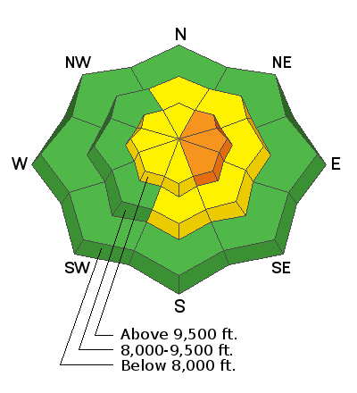
The steep upper elevations terrain where the wind has been drifting snow has a CONSIDERABLE avalanche danger. This is most pronounced on the more easterly facing terrain in the high elevations. Avoid steep slopes with recent deposits of wind drifted snow. In terrain where there are not freshly formed drifts, the avalanche danger is LOW to MODERATE.
Low
Moderate
Considerable
High
Extreme
Learn how to read the forecast here
Weather and Snow
The Skyline picked up 9 inches of snow in the last 24 hours. We may see a little more trickle in during the day but it won't stack up a whole lot more. The wind has been strong along the ridgetops over the last 24 hours from a westerly direction. Temperatures are currently in the mid teens.
Ad
Avalanche Problem #1
Wind Drifted Snow
Type
Location
Likelihood
Size
Description
With the strong wind that came with this storm you're main concern out there today is going to be the freshly wind drifted snow. The most likely places to find trouble are the upper elevation steep east facing bowls. However, the wind gets channeled through terrain in all different directions so watch for "pillowy" looking drifts on any steep terrain feature. Cracking within the snowpack is an indicator that things are sensitive.
Additional Information
This forecast is from the U.S. Forest Service, which is solely responsible for its content. This forecast describes general avalanche conditions and local variations always occur.