Forecast for the Skyline Area Mountains

Brett Kobernik
Issued by Brett Kobernik on
Monday morning, January 11, 2021
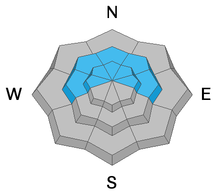
The danger is still CONSIDERABLE on steep west, north and east facing high elevation slopes. Human triggered avalanches will be more spotty and not all that large but are still likely. Continue to avoid slopes over 30 degrees in the described terrain.
Low
Moderate
Considerable
High
Extreme
Learn how to read the forecast here
Weather and Snow
Current Conditions: No big changes in conditions since Sunday. Temperatures were in the mid teens overnight with some locations in the drainage bottoms down into the single digits. Wind remains light.
Mountain Weather: It is going to be a "ho hum" week of weather. We'll see highs in the mid 20s today with generally light wind. The rest of the week looks similar with slightly warmer temperatures and increasing wind later in the week.
Ad
Avalanche Problem #1
Persistent Weak Layer
Type
Location
Likelihood
Size
Description
The snowpack remains weak and is becoming weaker the longer we go without new snow. The chances for triggering an avalanche will decrease until the next serious storm. At this point, I don't see that we are going to have a turnaround with our weak snowpack. I fear we will deal with unstable conditions through the remainder of the winter. The snowpack consisits of mostly sugary faceted snow at this time. This is sure to cause problems if we actually see significant snow added on top of it.