UDOT PLANNED AVALANCHE CLOSURES!!

Forecast for the Salt Lake Area Mountains

Nikki Champion
Issued by Nikki Champion on
Tuesday morning, March 4, 2025
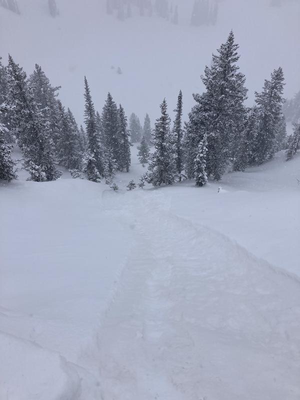
The avalanche danger is CONSIDERABLE across all upper-elevation slopes and mid-elevation slopes facing northwest through north and east, where strong winds and new snow have created dangerous avalanche conditions. It remains possible to trigger a 2–4 foot deep avalanche on a persistent weak layer.
On the remaining slopes, the danger is MODERATE, as periods of heavy snowfall and elevated winds have created heightened avalanche conditions today.
Outside the wind zone, both loose snow and slab avalanches may be possible within the new snow.

Careful snowpack evaluation, cautious route-finding, and conservative decision-making will be essential today.
Low
Moderate
Considerable
High
Extreme
Learn how to read the forecast here
Special Announcements
Join UAC Forecaster Nikki Champion at Lone Pine Gear Exchange on Wednesday, March 5th at 7:30 PM for an in-depth look at the snowpack, how we got here, and what’s next. Find more info HERE.

Join the UAC on Thursday, March 6th at Brewvies in Salt Lake for friends, drinks, prizes, and an action-packed film! Alpine Assassins is a movie about incredible backcountry sledding and adventure. Doors open at 6:30 PM. Get your tickets here.
Weather and Snow
This morning, under overcast skies, it's snowing in the mountains. Overnight, we picked up 2"-11" of new snow with .10-1.20" of water, bringing storm totals to 4"-19" of snow and 0.5"-1.60" of water. Temperatures are in the upper teens to mid-20s °F. Winds have shifted west-northwest, averaging 5-15 mph with gusts up to 25 mph at mid-elevation ridgelines and 20-30 mph, gusting into the mid-30s to 40s, at upper elevations. The highest ridgelines are pushing 70 mph this morning.
Today, temperatures will rise into the low 30s. Expect periods of snow this morning, turning partly cloudy with lingering snow showers in the afternoon. Winds will stay northwesterly, averaging 10-15 mph with gusts up to 25 mph at mid-elevations and 20-25 mph, gusting to 35 mph, at upper elevations. Daytime snowfall could add an additonal 5 inches.
The next storm, expected late Wednesday through Friday, looks promising, with 1.5 to 3.0 inches of water content, potentially bringing 18-36 inches of snow.
The range now holds a mix of snow surfaces beneath the new snow. South-facing and lower north-facing slopes likely have a stout crust, while upper north-facing terrain has recrystallized near-surface facets disguised as soft powder. With this storm, the new snow and wind slabs have prime bed surfaces across all aspects and all elevations, making even light wind and snow enough to trigger long-running sluffs or sensitive slabs.
Recent Avalanches
Yesterday, there were reports of long, fast-running loose dry avalanches on the old snow/new snow interface in the backcountry. Ski resorts also reported a few sensitive, shallow wind drifts.
Ad
Avalanche Problem #1
Wind Drifted Snow
Type
Location
Likelihood
Size
Description
Overnight, winds ramped up, with gusts hitting 70 mph at upper-elevation ridgelines. With plenty of soft snow available for transport, these strong winds continue to form soft slabs of wind-drifted snow. As winds remain elevated throughout the day, expect these slabs to grow larger and more cohesive. While most pronounced on leeward slopes, such high winds can load any aspect as they swirl and shift through the terrain.
Approach steep terrain features where drifting snow has accumulated with caution. Watch for rounded, wavy, or pillowy snow, and be alert for signs of instability, such as cracking and collapsing.
All this new and wind-drifted snow is landing on ideal bed surfaces, making it prone to shallow but sensitive sluffs and slabs.
Avalanche Problem #2
New Snow
Type
Location
Likelihood
Size
Description
As of this morning, some areas have received up to 18 inches of snow and 1.6 inches of water, with heavy snowfall continuing in the mountains. We should be mindful of how this new snow bonds to the underlying surfaces. Soft slabs and dry-loose avalanches are the primary concerns today, with failures possible both within the new snow (due to density changes) and at the old/new snow interface.
Watch for signs of instability, such as cracking and sluffing, as even a small slide can have serious consequences in steep terrain or near cliffs. Assess stability carefully before committing to steep slopes.
Example of the easy sluffing seen - Silverfork (DB)
Avalanche Problem #3
Persistent Weak Layer
Type
Location
Likelihood
Size
Description
It’s still possible to trigger a 2–4 foot deep avalanche on a persistent weak layer, and the snowpack remains highly variable. While these layers may be slowly transitioning toward dormancy, it's unclear how they will respond to the recent loading from new snow and wind.
Snow depths vary significantly across the range. In some areas, the snowpack is deep and strong, measuring 6 feet or more. In contrast, slopes that have previously avalanched are much shallower—around 2–4 feet—with weak, faceted snow near the bottom. At one location, Dave Kelly observed full propagation results, a clear sign that slab avalanches are still possible in certain terrain.
For now, probe and dig before committing to steep, north-facing terrain. Slopes that have recently avalanched are the most likely to harbor lingering weak layers, and steep, rocky terrain with shallow snowpacks remains the most suspect for weak, faceted snow.
What remains uncertain is whether this storm will be enough to reactivate the persistent weak layer. However, these slopes are still the most dangerous, as any additional loading from new snow and wind could tip the balance. If the weak layer does wake back up, avalanches in these areas will be large and destructive. Given the uncertainty, the safest move today is to step back and continue avoiding steep, shady terrain where these layers persist.
General Announcements
This information does not apply to developed ski areas or highways where avalanche control is normally done. This forecast is from the U.S.D.A. Forest Service, which is solely responsible for its content. This forecast describes general avalanche conditions and local variations always occur.