


Forecast for the Salt Lake Area Mountains

Issued by Nikki Champion on
Monday morning, March 3, 2025
Monday morning, March 3, 2025
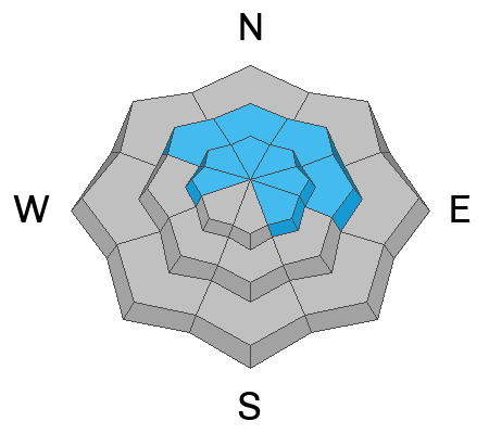
The avalanche danger is MODERATE on mid and upper-elevation slopes facing northwest through east, as well as some upper-elevation slopes facing west and southeast, where triggering a 2–4 foot deep avalanche on a persistent weak layer remains possible.
As a storm system moves through northern Utah this afternoon, avalanche danger will also rise to MODERATE on all upper-elevation slopes, with sensitive shallow slabs of wind-drifted snow developing. Assess snow and terrain carefully.

Low
Moderate
Considerable
High
Extreme
Learn how to read the forecast here
 Special Announcements
We are excited to announce the launch of our new mobile application available on both Android and IOS. Get all the information you need to plan your backcountry adventure and keep the information at the tip of your fingers while you are out. Install the Android version here and the IOS version here.
Join the UAC on Thursday, March 6th at Brewvies in Salt Lake for friends, drinks, prizes, and an action-packed film! Alpine Assassins is a movie about incredible backcountry sledding and adventure. Doors open at 6:30 PM. Get your tickets here.
 Weather and Snow
This morning, under overcast skies, temperatures are in the upper teens to mid-20s °F. Winds are southeast at 5-10 mph with gusts up to 15 mph at mid-elevation ridgelines and 10-15 mph with gusts reaching the mid-20s at upper elevations. Wind speeds peaked early, with gusts around 50 mph. By 5 AM, snowfall accumulation across the range averaged 1-2 inches.
Today, temperatures will rise into the mid to upper 20s. A weak storm system will pass through today and tonight, but most of the snow will miss the northern mountains. Winds will shift westerly, averaging 5-20 mph with gusts up to 35 mph at higher ridgelines. Light snow is possible this afternoon, but the best chance for steady snowfall comes tonight through Tuesday morning. Daytime totals may range from a trace amount to 3 inches, while overnight totals are expected to be closer to 6-10 inches, bringing most of the precipitation.
The next storm, expected late Wednesday through Friday, looks promising with 1.5 to 2.5 inches of water content, potentially bringing 18-30 inches of snow.
With the general drop in temperatures, the range now holds a mix of snow surfaces. South-facing slopes, along with low- and even some mid-elevation north-facing terrain, will likely have a stout crust. Meanwhile, upper-elevation north-facing terrain may have a few inches of what looks like "soft settled powder" but, as Drew noted in his observation, is actually recrystallized near-surface facets. This means that as the next two storm systems roll into northern Utah, the new snow and any shallow wind slabs will have excellent bed surfaces to fail on across all aspects. Even a small amount of wind and snow could lead to shallow, long-running sluffs or sensitive soft slabs.
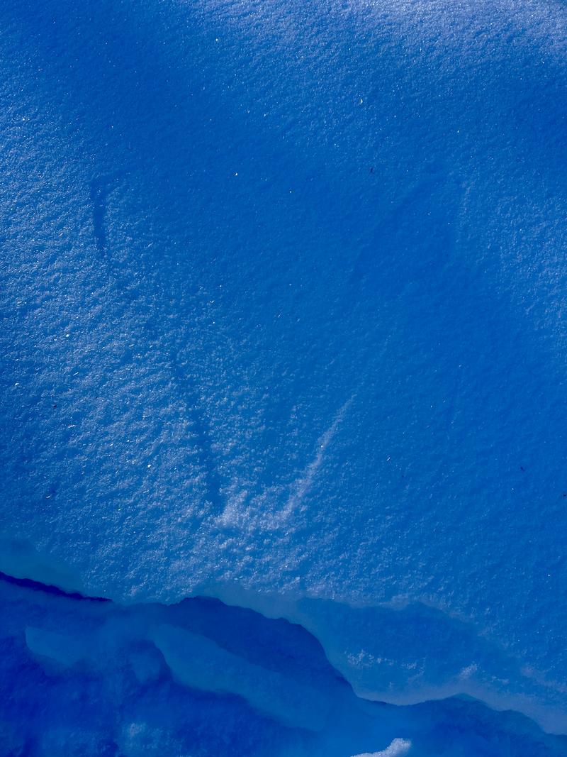
Photo of weak surface snow - Scotts Backdoor
 Recent Avalanches
One report of a natural wet-loose avalanche on south-facing terrain in Little Cottonwood; otherwise, no new avalanches were reported from the backcountry.

Avalanche Problem #1
Persistent Weak Layer
Type
Location
Likelihood
Size
Description
It’s still possible to trigger an avalanche 2–4 feet deep on a persistent weak layer, though these layers are slowly becoming less reactive as they move toward dormancy. The likelihood of triggering one decreases each day, but the snowpack remains highly variable.
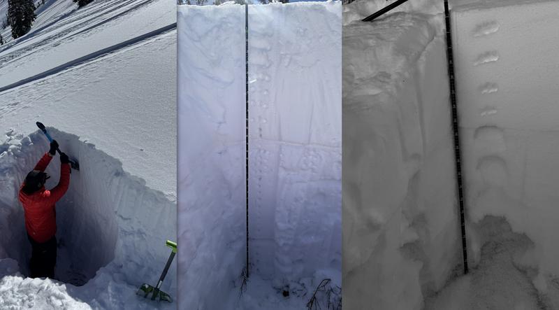
Across the range, snowpit depths vary significantly. In some areas, the snowpack is deep and strong, with total depths up 6 feet or deeper. In contrast, slopes that have previously avalanched have much shallower snowpacks—around 2-4 feet —with weak faceted snow near the bottom. At one locations, Dave Kelly observed full propagation results, exactly the type of place where a slab avalanche could still be triggered.
For now, continue probing (checking depth) and digging into the snowpack before committing to any steep, north-facing terrain. Make sure the slope hasn’t avalanched recently, as these areas are more likely to have lingering weak layers. Steep, rocky terrain or slopes with a shallow snowpack are also prime suspects for holding weak faceted snow. The safest option is to keep avoiding steep, shady terrain where these layers still exist.
Example of varying snowpit depths across the range—on the right is the deeper snowpack, and on the left is the shallower repeater slope.
Avalanche Problem #2
Wind Drifted Snow
Type
Location
Likelihood
Size
Description
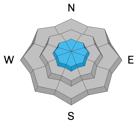
Winds gusted up to 50 mph overnight from the southeast. East is our least favorite wind direction due to the challenges it poses for getting accurate readings on our weather stations, as well as its uncommon nature.
The winds will shift to the north and northwest by this afternoon. Any lingering cold snow, combined with fresh snowfall from today, could create shallow wind drifts in upper-elevation terrain throughout the day.
New wind drifts or snow will settle on various good bed surfaces, making them prone to shallow but sensitive sluffs or slabs of wind-drifted snow.
General Announcements
This information does not apply to developed ski areas or highways where avalanche control is normally done. This forecast is from the U.S.D.A. Forest Service, which is solely responsible for its content. This forecast describes general avalanche conditions and local variations always occur.