Join us at our 2nd Annual Blizzard Ball

Forecast for the Salt Lake Area Mountains

Paige Pagnucco
Issued by Paige Pagnucco on
Wednesday morning, December 18, 2024
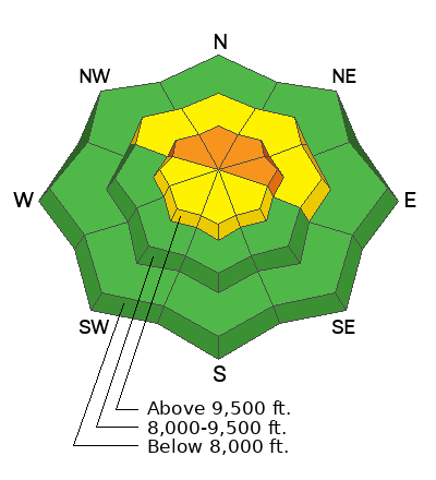
The avalanche danger is CONSIDERABLE on upper-elevation northwest to north to east-facing slopes, where you could trigger avalanches failing on buried weak, faceted snow. These avalanches could be 1 to 3 feet deep and possibly up to hundreds of feet wide.
A MODERATE avalanche danger exists in upper-elevation west to southeast-facing terrain and mid-elevation northwest to north to east-facing terrain. Avalanche danger is LOW on all other aspects.
Today's primary concern continues to be triggering wind slabs that fail on weak, faceted snow. Cautious route-finding and conservative decision-making are crucial for safe travel.
Low
Moderate
Considerable
High
Extreme
Learn how to read the forecast here
Weather and Snow
Mountain temperatures this morning are hovering in the mid-20s °F, with some trailheads in the teens. Winds are blowing from the west-northwest at around 15 MPH with gusts in the 20s MPH. Overnight, max gusts at 11,000' were about 70 MPH. The mountains picked up 1-3 inches of medium-density snow yesterday, greatly improving the still early-season conditions.

Today, expect fairly benign weather with mostly sunny skies and temperatures in the 30s °F. Some high clouds roll in this afternoon, and winds from the west-northwest should pick up a bit, with 11,000' ridgelines seeing 20-30 MPH and gusts near 40 MPH. We are locked into high pressure for the rest of the work week.

Yesterday, we found poor snowpack structure and poor stability in our test pits. Uphill travel is decent, but many just-buried obstacles are ready to ruin your season. We have a classic strong snow over weak snow set-up in most areas but signs of instability like cracking and collapsing are decreasing. Today, you'll find the best riding on low-angle, sheltered slopes facing the north half of the compass.
*We may see wet, loose activity on sun-baked slopes with warm temperatures on tap for today.
Early season, shallow conditions.
Recent Avalanches
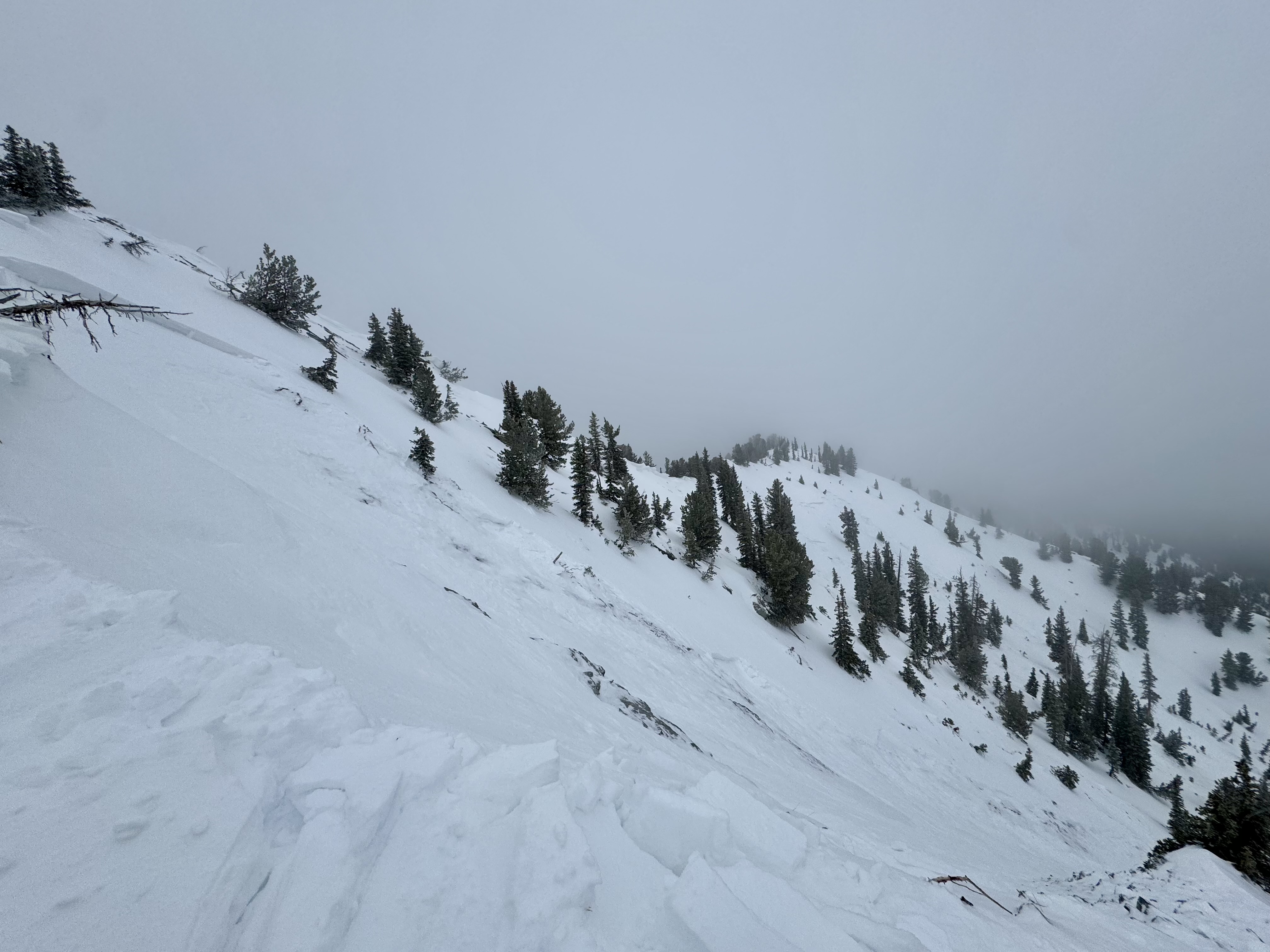
Yesterday, we had a few reports of natural and human-triggered avalanches in upper-elevation, mostly east-facing terrain.
A skier triggered an avalanche in Main Days. It was about 2 feet deep and about 800 feet wide.
Read all observations here.
Ad
Avalanche Problem #1
Persistent Weak Layer
Type
Location
Likelihood
Size
Description
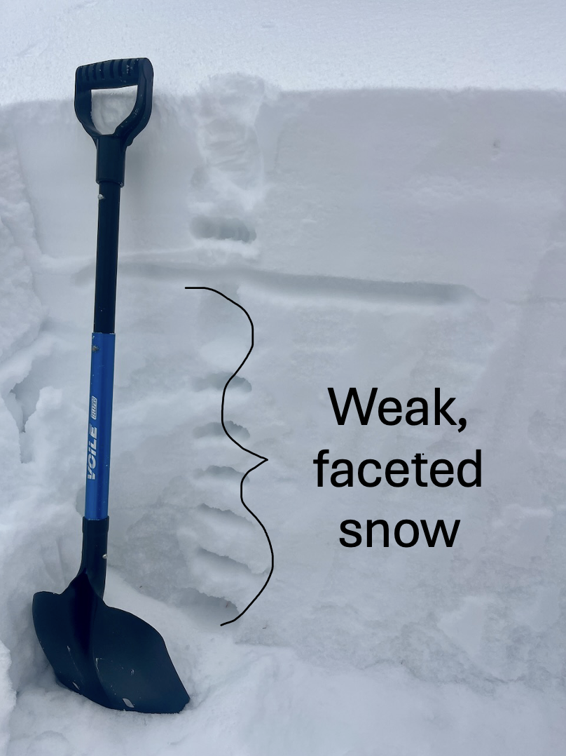
There are two buried weak layers in the snowpack. The first, a thick layer of facets, is 1 to 8 inches above the ground. The second, a surface weakness from early December's high pressure, lies just beneath the newest snow.
The faceted layer is easy to spot in snowpits, but the buried surface weakness may be harder to find. It’s 6 to 12 inches deep and may be patchy, as high winds and warm temperatures could have destroyed it.
Avalanche Problem #2
Wind Drifted Snow
Type
Location
Likelihood
Size
Description
The wind has been the big player recently, loading mid and upper-elevation slopes that had preexisting weak, faceted snow. Wind slabs can provide just enough support to allow you to venture further onto the slope before they fail, making them particularly dangerous and difficult to identify. Look for and avoid pockets of wind-drifted snow near ridgelines and terrain features like gullies and rock outcroppings.
General Announcements
This information does not apply to developed ski areas or highways where avalanche control is normally done. This forecast is from the U.S.D.A. Forest Service, which is solely responsible for its content. This forecast describes general avalanche conditions and local variations always occur.