Forecast for the Salt Lake Area Mountains

Issued by Trent Meisenheimer on
Sunday morning, January 26, 2025
Sunday morning, January 26, 2025
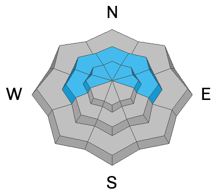
Pockets of MODERATE avalanche danger exist on all aspects at the upper elevations and on mid-elevation aspects facing west through north and east where it is possible to trigger an old hard slab avalanche or a new shallow soft slab of wind-drifted snow.
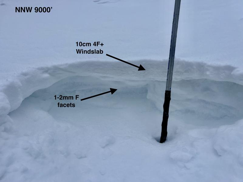
On northerly and east-facing slopes at the mid and upper elevations, there is a MODERATE danger of triggering an avalanche that fails 2-4 feet deep in a persistent weak layer.
As the sun warms the southerly-facing terrain be on the lookout for shallow wet-loose avalanches.
As the sun warms the southerly-facing terrain be on the lookout for shallow wet-loose avalanches.

Low
Moderate
Considerable
High
Extreme
Learn how to read the forecast here