Join us at our 2nd Annual Blizzard Ball

Forecast for the Provo Area Mountains

Drew Hardesty
Issued by Drew Hardesty on
Saturday morning, April 11, 2020
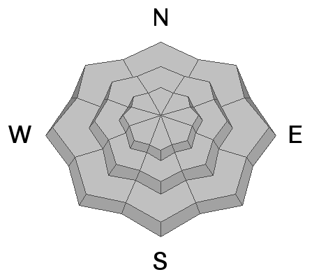
The avalanche danger is LOW, but could possibly rise to MODERATE due to warming of the snowpack.
Wind and cloud cover may slow the softening of the snow surfaces on some slopes, but not others. Watch how the snow is behaving: if you find sloppy or punchy wet snow, move to low angle terrain or head home.
Low
Moderate
Considerable
High
Extreme
Learn how to read the forecast here
Special Announcements
The Avalanche Research Program at Simon Fraser University is conducting an online survey to examine how people use avalanche safety information. They want to hear from all backcountry users to understand how they process information provided in public avalanche forecasts. Anyone who completes the survey before May 15th will be entered to win cash prizes.
Chapter 7 of the Low Danger Series - The Crossing
Weather and Snow
Skies are partly cloudy.
5am mountain temperatures are in the mid-30s.
Winds aloft veered to the west with most anemometers spinning 20-25mph with gusts to 30. The highest anemometers, ahead of tonight's storm, are indicating wind speeds of 25-30mph with gusts to 40.
Most snow surfaces should have at least a marginal refreeze. Some surfaces may have trouble softening today due to the wind and localized cloud cover.

A Return to Winter - A strong cold front is expected to push through overnight that should produce 1-3" of snow, perhaps a touch more in some locations. Grab the down jacket again - ridgetop temps tomorrow will drop to the single digits and low teens. West to northwest winds will be moderate to strong early evening into early tomorrow. Ahead of the cold front, today we'll see increasing clouds, afternoon spring showers, graupel, possibly some lightning. Temperatures will rise to the upper 30s along the ridgelines and the mid to upper 40s down low. Temps remain cool through the week.
Recent Avalanches
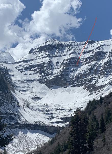
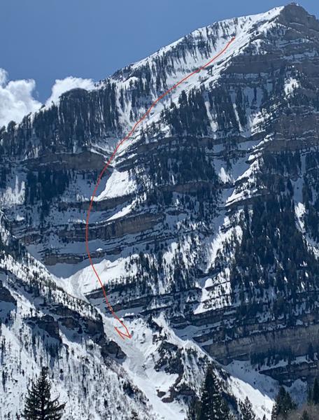
During our outing above Aspen Grove yesterday, we watched the sun and heating trigger long running wet sluffs in the NE Chute of Elk Point and off the Robert's Horn ridgeline...each leaving some fresh piles of "wet concrete" in the runout zones below.
Ad
Avalanche Problem #1
Normal Caution
Type
Location
Likelihood
Size
Description
The overall avalanche danger is LOW, possibly rising to MODERATE this afternoon due to warming of the snowpack. In general, wet avalanche activity is managed most effectively by timing - once the snow surface becomes wet and sloppy, it is time to move to a shadier aspect. Watch for signs of wet, loose snow including rollerballs and sluffing in the wet snow.
However, avalanche concerns in the spring can become complicated, and other concerns to watch for today include:
1. Wet slabs - yesterday we found a supportable melt-freeze crust that started to deteriorate by midday and the crust started to fail and collapse on loose wet grains below. It did not avalanche, but the audible collapsing is a red flag.
2. Cornices - Cornices in some places are massive, and they can break off naturally, especially during warm weather when they start bending downhill. Simply avoid being underneath or near the tops of large cornices as they break farther back than expected.
Additional Information
Information on outdoor recreation - The State of Utah created this webpage with information about recreating on both state and federal public lands during the current health crisis.

Skiing and riding at closed ski resorts - Some resorts allow access now, and some do not. Please check HERE for the latest info on ski area access.

New to the backcountry (including riding at closed resorts) - Watch the award-winning, 15 minute Know Before You Go video, or take the 5-part, free online-learning series.
General Announcements
This information does not apply to developed ski areas or highways where avalanche control is normally done. This forecast is from the U.S.D.A. Forest Service, which is solely responsible for its content. This forecast describes general avalanche conditions and local variations always occur.