Forecast for the Provo Area Mountains

Issued by Nikki Champion on
Monday morning, March 29, 2021
Monday morning, March 29, 2021
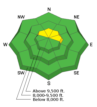
Most terrain has a generally LOW avalanche danger. However, areas of MODERATE danger exist across upper-elevation north-facing terrain for the possibility of triggering a fresh slab of wind drifted snow. These wind slabs will be generally shallow and isolated to terrain features that allow for drifting snow to accumulate.
Slide-for-life: Many snow surfaces will be frozen solid this morning - falling in steep terrain and being unable to stop on hard, refrozen snow surface is a definite travel hazard.
The cooler temperatures should cause the amount of wet avalanche activity to decrease but pay attention to changing conditions and be prepared to alter your plans if the precipitation comes in as rain, and the snow surface becomes extremely wet.

Low
Moderate
Considerable
High
Extreme
Learn how to read the forecast here


