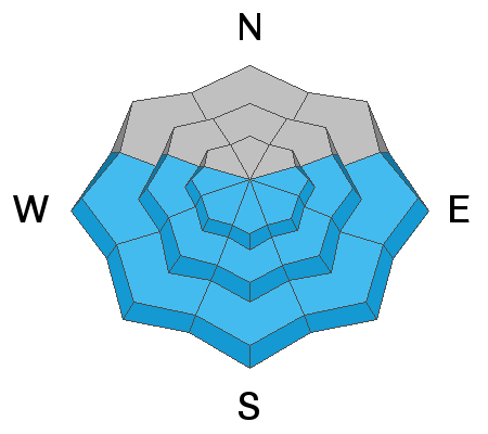
The 2021 Spring Awareness Campaign is underway. Help us save lives through avalanche forecasts and education. Consider making a donation to show your support
HERE.
Yesterday had mostly cloudy skies but periods with the sun appeared. High temperatures ranged from the mid 30s to low 40s F. Despite some impressive looking spring storms rolling though the area, only a trace to one inch of new snow fell yesterday afternoon.
This morning, temperatures are mostly in the mid to upper 20s F. Winds are blowing 5 mph gusting to 10 mph from the west and southwest and a bit stronger at the highest elevations.
Today's strong sunshine will help temperatures warm up quickly and rise into the low 40s F. Winds will remain light and will shift to the north and then back to the west and then to the southwest. A decent storm should arrive Friday night and could bring 4-6 inches of snow.
There were some small wet loose avalanches that happened yesterday like the one below in
West Monitor along the Park City ridgeline. (photo - Chester)
On Monday there was one slab of wind drifted snow triggered on Mill Canyon Peak on an upper elevation, southeast facing slope that broke 8 inches deep and 100 feet wide. Nobody was caught. (photo - Wasatch Powderbird Guides)
Find all observations and reported avalanches
HERE.


