Join us at our 2nd Annual Blizzard Ball

Forecast for the Provo Area Mountains

Trent Meisenheimer
Issued by Trent Meisenheimer on
Tuesday morning, March 16, 2021
Today the avalanche danger is MODERATE on all aspects at the upper elevations for triggering a small slab of wind drifted snow. Look for and avoid steep slopes that have been recently loaded by the wind.

Recall that even a small avalanche can be problematic, especially in very steep and complicated terrain. Think about the terrain you are traveling above today. If it avalanches, where do you go? What are the consequences?
Low
Moderate
Considerable
High
Extreme
Learn how to read the forecast here
Special Announcements
Four riders were boot packing up the east ridge of the Pfeifferhorn when a shallow 2-6 inch deep wind slab failed. All four people were caught and carried, and some suffered injuries. Link to the report can be found HERE.
Weather and Snow
This morning it's trying to snow lightly in the mountains as a closed low (storm) currently sits over Las Vegas. As this closed low spins counter-clockwise (cyclonic) and moves eastward, we hopefully will see some spillover moisture on an easterly flow. Typically this is not a good pattern for accumulating snow for Northern Utah or the Provo Range. Fingers crossed that we can stack some flakes. As this storm moves eastward into Arizona, we could see an increase in the east winds today, with speeds hitting 10-20 mph at the uppermost ridgelines.
Current mountain temperatures are in the upper 20's to low 30's °F. Winds are from the northeast and blowing 5-10 mph. Hopefully, the winds will remain calm, but with east winds, you never know. The snow surface has taken a beating over the past few days from warm temperatures, sun, and wind. Only mid to upper elevation wind and sun-protected slopes held dry settled powder snow.
Recent Avalanches
We had one report of a wind slab avalanche from the Wasatch Powder Birds off of Mill Canyon Peak. This avalanche was on an upper elevation southeast facing aspect and broke 8 inches deep and 100 feet wide. Nobody was caught. You can find all the recent avalanche activity HERE.
Photo: Courtesy of the Wasatch Powder Birds.
Ad
Avalanche Problem #1
Wind Drifted Snow
Type
Location
Likelihood
Size
Description
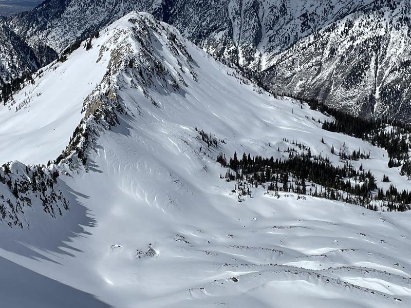
Over the weekend, the wind blew from different directions at speeds of 20-30 mph with gusts into the 60's. The wind also blew from the east, creating drifts/wind slabs in unusual locations. I would continue to be on the lookout for lingering drifts of wind-blown snow as some drifts could still be sensitive to the weight of humans. Unfortunately, it could be hard to see these old drifts if they get buried by a few inches of snow.
Photo: Staples and Champion showing the weekend's wind drifted snow. Notice the pillowy, wavy snow; that's a wind slab.
Additional Information
The 2021 Spring Awareness Campaign starts today! - Help us save lives through avalanche forecasts and education. Consider making a donation to show your support.”
General Announcements
Please visit this website with information about Responsible Winter Recreation by the Utah Office of Outdoor Recreation.

This information does not apply to developed ski areas or highways where avalanche control is normally done. This forecast is from the U.S.D.A. Forest Service, which is solely responsible for its content. This forecast describes general avalanche conditions and local variations always occur.