Forecast for the Provo Area Mountains

Drew Hardesty
Issued by Drew Hardesty on
Thursday morning, December 26, 2019
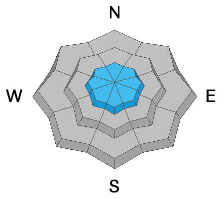
Areas of MODERATE DANGER exist for human triggered sluff and storm slab avalanches on all aspects and most pronounced in (but not limited to) the upper elevations. Human triggered avalanches are possible. Be aware of other parties above or below you.
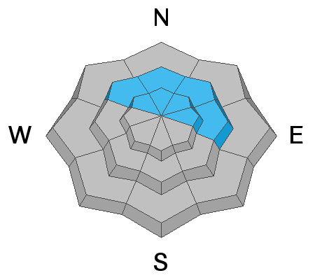
A pockety MODERATE DANGER ALSO EXISTS for triggering an avalanche 2-5' deep on northwest through east facing aspects. Continue to avoid steep rocky terrain as well as repeater slopes that have already avalanched this season.
Low
Moderate
Considerable
High
Extreme
Learn how to read the forecast here
Special Announcements
New blog post-Landmines -
With permission, I am reprinting a recent piece of correspondence from an Army officer who is frequently deployed to the middle east. I spent time in the middle east as a naval intelligence officer in Desert Storm in the early 90s.

New podcast - Risk, Reward, and the Big Lie - A Conversation with Ski Guide Doug Workman

Jenna Malone's UAC Podcast - Betting Your Life - Why Forecasting is Poker and Not Chess - A Conversation with Jenna Malone - now has her video presentation from this fall's USAW.

Thanks to the generous support of our Utah ski resorts and Ski Utah, we have discount lift tickets available. All proceeds from these go towards paying for avalanche forecasting and education! Get your tickets here.
Weather and Snow
Skies are mostly cloudy with a trace to an inch of snow overnight. Snowfall since Monday eve are 4-7"/0.42"SWE. Winds are hardly a whisper; temps are in the upper teens to low 20s. Snow depths are 35-45" in the mid-elevations.
For today, we'll have thinning clouds by evening with light southwest winds and temps in the 20s. Cooler temps by Friday night into Saturday.
Recent Avalanches
None reported.
Ad
Avalanche Problem #1
New Snow
Type
Location
Likelihood
Size
Description
Sluffs and shallow storm snow avalanches are still possible in steep terrain of all aspects at the mid and upper elevations. Generally, these soft avalanches are predictable and manageable but may pile up deeply in terrain traps.
Danger Trend: Decreasing
Avalanche Problem #2
Persistent Weak Layer
Type
Location
Likelihood
Size
Description
A dangerous structure of a strong slab of snow over a persistent weak layer of faceted snow down near the ground exists on mid and upper elevation aspects facing northwest, through north, and east. Although this weak layer has become mostly dormant over the past week, several days of southerly winds over this past weekend and through Tuesday have created dense wind slabs on the aspects where this weak layer can be found. Additional stress to this suspect layering is the recent 7"+ of snow in the past couple days.
Slopes that have a thinner and weaker snowpack are the most susceptible, this includes:
- steep rocky terrain;
- repeater slopes that have already avalanched this season
If you choose to enter the terrain where this avalanche problem exists, consider the consequences of triggering one of these large avalanches.
Danger Trend: Steady to Decreasing

General Announcements
This information does not apply to developed ski areas or highways where avalanche control is normally done. This forecast is from the U.S.D.A. Forest Service, which is solely responsible for its content. This forecast describes general avalanche conditions and local variations always occur.