Join us at our 2nd Annual Blizzard Ball

Forecast for the Provo Area Mountains

Drew Hardesty
Issued by Drew Hardesty on
Tuesday morning, December 22, 2020
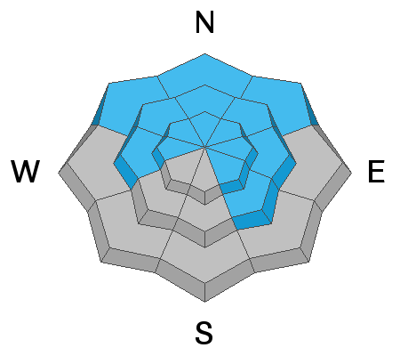
A CONSIDERABLE avalanche danger exists on many slopes at the mid and upper elevations. Human triggered avalanches 1-2' deep remain likely...and may still be triggered from a distance.
The danger for new snow and wind slabs will also be on the rise today. Know that any new snow avalanche in steep shady terrain may step down and trigger a much deeper avalanche.
Conservative decision making and awareness of changing conditions will be essential today.
Low
Moderate
Considerable
High
Extreme
Learn how to read the forecast here
Special Announcements
Thanks to the generous support of our local resorts, Ski Utah, and Backcountry, discount lift tickets are now available. Support the UAC while you ski at the resorts this season. Tickets are available here.
Weather and Snow
Skies are clear...but not for long.
A sharp and quick hitting cold front will arrive before noon and snowfall will continue into the night. The NWS has issued a Winter Weather Advisory and - if everything aligns right - we may see 2-5" (or more) in the Provo mountains. Southwesterly winds picked up in the early morning hours with hourly averages of 30-35mph. Gusts at 11,000' have reached 80mph. Current mountain temps are in the upper 20s up high, the upper 30s down low. The highest elevations may flirt with 0°F by late tonight. Unfortunately it does look as if the northwest winds will remain gusty well after frontal passage today.
We'll need this snow - wind, sun and terribly warm temperatures have taken their toll on the snow conditions.
The Outlook:
We should see clearing skies tomorrow through Friday. We'll see gradually warming temperatures through the end of the week with a storm slated for Saturday that should bring another round of snow.
Recent Avalanches
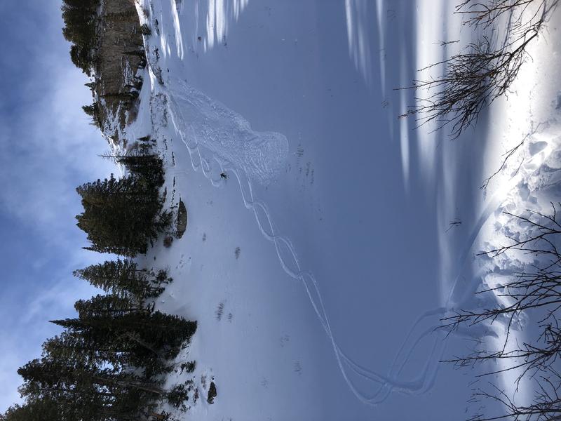
On Sunday, my partners and I experienced widespread cracking and collapsing from 7000' up to nearly 9500'. We intentionally triggered two small pockets 15" deep and 30' wide (photo) on very steep rollovers; each running on the old faceted snow from November. The full write-up of our field day can be found HERE>
Ad
Avalanche Problem #1
Persistent Weak Layer
Type
Location
Likelihood
Size
Description
While we heard of our avalanche activity yesterday, collapsing and long shooting cracks along with damning snowpack tests are evidence enough of a generally unstable snowpack. These avalanches are what we call 'Unmanageable' - that is, they are predictable in their unpredictability: they may be triggered at a distance or from below. Note that many of these avalanches rip out mid slope and well off the ridgelines.
Continue to give yourself plenty of margin. Travel advice would be to stick to low angle terrain until the snowpack has adjusted.
The snowpack has a hard time adjusting with every event that adds additional stress - like the previous days' strong northwest winds along the exposed ridgelines.
These avalanches are failing on the NFL - the November Facet Layer - and unfortunately leave plenty of faceted grains on the bed surface, waiting for the next slab of snow. These are called Repeater avalanches. Repeater slopes can be particularly tricky as they can be difficult to identify with the next blanket of snowfall.
Avalanche Problem #2
Wind Drifted Snow
Type
Location
Likelihood
Size
Description
Although yesterday's sun and warming may have limited the overall snow available for transport, there is some...and there will likely be more drifting during and after the midday cold front. Look for and avoid any fresh deposits of wind blown snow. Owing to previous and expected moderate to strong winds, drifts may be found on a variety of aspects although they'll be more pronounced along the higher elevations.
Avalanche Problem #3
New Snow
Type
Location
Likelihood
Size
Description
By the afternoon, you may be able to trigger shallow new snow avalanches in the steepest terrain. The new snow is likely to bond fairly well with many of the warm, corrugated crusts on the east to south to west aspects and bond less favorably on the northerly aspects. Note that new snow avalanches are particularly sensitive when snowfall rates are the highest....and aspect doesn't matter.
Additional Information
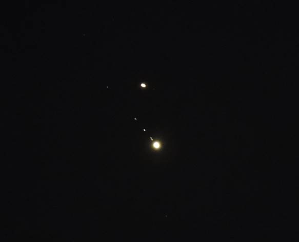
Many years ago, one of the Little Cottonwood Canyon snow rangers, Peter Lev, attempted to find a correlation between the moon's gravitational pull with avalanche activity. His "tidal charts" are still used today by some avalanche operations. He recently told me that the original idea came from his co-worker Binx Sandahl. I wonder what their opinions would be of the Jupiter and Saturn overlap in the early evening Solstice sky? (photo of the planets and the moons of Jupiter sent by one of Lev's old colleagues). The last time the planets appeared this close and could be seen from the ground was in 1226.
General Announcements
Please visit this website with information about Responsible Winter Recreation by the Utah Office of Outdoor Recreation.

This information does not apply to developed ski areas or highways where avalanche control is normally done. This forecast is from the U.S.D.A. Forest Service, which is solely responsible for its content. This forecast describes general avalanche conditions and local variations always occur.