Join us at our 2nd Annual Blizzard Ball

Forecast for the Provo Area Mountains

Nikki Champion
Issued by Nikki Champion on
Tuesday morning, November 24, 2020
The avalanche danger is LOW and avalanches are unlikely.
The biggest concern is slide-for-life conditions on the slick crusts and getting injured in the shallow snowpack by hitting rocks or other obstacles.
Remember, a few inches of low-density snow will only disguise the firm and shallow conditions that lie below, continue to tread lightly.
Low
Moderate
Considerable
High
Extreme
Learn how to read the forecast here
Special Announcements
Please do everything possible to avoid getting hurt for yourself and the greater good. As you decide where and how to travel in the backcountry, consider adding just a little extra margin of safety.

Announcement: Please visit this website with information about Responsible Winter Recreation by the Utah Office of Outdoor Recreation.

If you missed the 13th Annual Utah Snow and Avalanche Workshop, the recordings are available for purchase from the UAC Store.
Weather and Snow
This morning, the weak weather system has moved its way out of our area leaving behind T-1" of low-density snow. Temperatures are in the mid-20s F at trailheads and low 20s F at upper elevations. Winds are currently Northwesterly, blowing 5-10 mph at most elevations with gusts near 25 mph at the upper-most ridgelines.
Today skies will clear and the temperature will begin to rise to the upper 20s F. Winds will continue to be Northwesterly averaging 5-10 mph, with gusts above 20 mph. This afternoon winds will begin to switch to more southwesterly. Today the windchill will be right near zero.
We are entering another brief period of high pressure, which will leave us with clear skies until the next weak system works its way through the area for Thanksgiving.
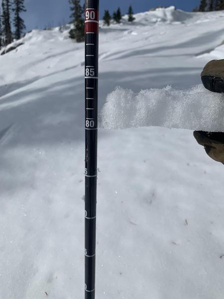
Before these few inches of light snow, the backcountry was full of a variety of snow surfaces right now, primarily firm crusts. Remember, 1" of low-density snow will only thinly cover these dangerous and firm riding conditions, continue to ride with caution.
Recent Avalanches
No new avalanches were reported from the backcountry yesterday.
For recent observations from the backcountry, click HERE....or find them in the Observations and Avalanches tab in the Menu above.
Ad
Avalanche Problem #1
Normal Caution
Type
Location
Likelihood
Size
Description
The snow is generally stable and the danger is LOW. Traveling in the backcountry, you will find a variety of firm crusts which can lead to slide for life conditions, this means if one falls in steep terrain they would unable to arrest on the slick crust below. In areas not covered by the firm variety of crusts, you will find hammered wind board, a shallow snowpack, or completely bare spots now covered with 1" of low-density snow.
While avalanches are unlikely today with such shallow or firm early-season conditions, getting caught in even a small avalanche or sliding on a frozen slope could have dire consequences with so many exposed hazards.
Photo of the firm crust in Upper Big Cottonwood Canyon. (PC: Chasen)
Continue to travel with care in the backcountry, identity grassy slopes that don't have hazards on them, and begin making a mental map of where this pre-existing snow exists for when winter returns.
Additional Information
Forecaster's Corner:
With clear skies and cold temperatures, the surface snow on the north side of the compass begins to become weak and faceted and generally lose cohesion (see Mark White video below). In the short term, this means you can buy a soft turn here or there, but in the long term it becomes a very real sliding surface for future avalanches whenever we see the next significant storms. At this point, the snow surfaces are quite variable, but it will be something to keep an eye on in the coming days (or weeks).
For the layperson, remember that ingredients for an avalanche often involve strong cohesive snow sitting above weak, sugary snow. Sugary faceted (angular) snow below.
General Announcements
This information does not apply to developed ski areas or highways where avalanche control is normally done. This forecast is from the U.S.D.A. Forest Service, which is solely responsible for its content. This forecast describes general avalanche conditions and local variations always occur.