Join us at our 2nd Annual Blizzard Ball

Forecast for the Provo Area Mountains

Drew Hardesty
Issued by Drew Hardesty on
Thursday morning, January 14, 2021
Areas of CONSIDERABLE DANGER exist on many steep slopes at the mid and upper elevations. Tricky and stubborn hard wind drifts may surprise backcountry travelers on steep wind loaded terrain. You may still be able to trigger a larger avalanche into older buried weak layers 1-3' deep in west to north to easterly facing aspects at the mid and upper elevations. Cautious route-finding and conservative decision making is essential.
REMEMBER - IF YOU ARE GOING OUT OF BOUNDS AT A SKI AREA, YOU ARE STEPPING INTO CONSIDERABLE AVALANCHE DANGER.
Low
Moderate
Considerable
High
Extreme
Learn how to read the forecast here
Special Announcements
Thanks to the generous support of our local resorts, Ski Utah, and Backcountry, discount lift tickets are now available. Support the UAC while you ski at the resorts this season. Tickets are available here.
Weather and Snow
Skies are clearing this morning in the wake of the overnight cold front.
After yesterday's heat wave, mountain temperatures have mercifully dropped into the low 20s.
In the central Wasatch, there were gusts over 100mph overnight along the highest elevations. Current hourly averages of weather stations in Provo are 20-25mph with gusts to 40.

For today, we'll see clearing skies, moderate to strong northwest winds, and mountain temps in the 20s.
A warming trend puts mountain temps tomorrow yet again beyond freezing with continued winds perhaps through overnight Friday into Saturday.
A weak system moves through Friday night ahead of some glimmer of promise for next week.
Recent Avalanches
We didn't hear of any avalanche activity in Provo, but suspect wet avalanche activity was also noted at the mid and low elevations.
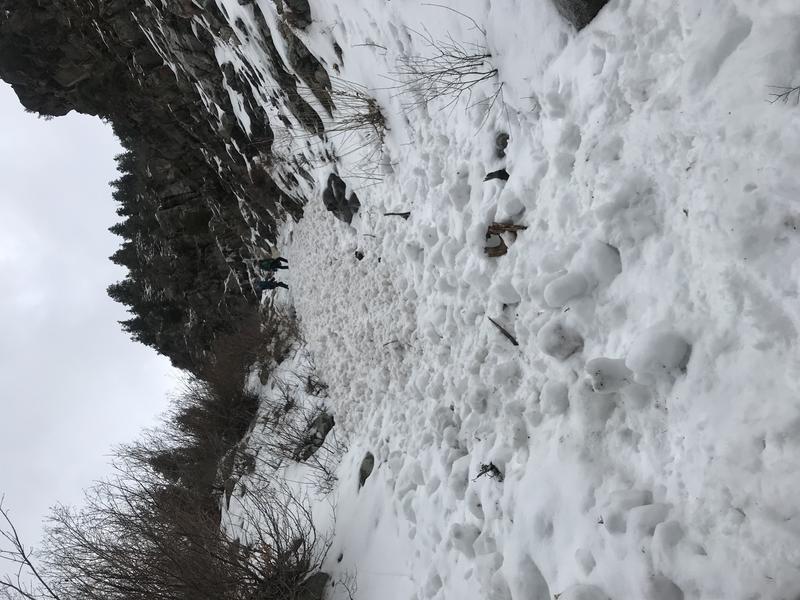
In the central Wasatch, warming temperatures provoked some wet loose sluffing in shady terrain at and below 9000'. An ice climbing party near the bottom of Hogum Fork in LCC experienced a harrowing experience of being engulfed in wet loose debris cascading down from above.
The climbers decided to bail and "down climbing, before I made it back to my anchor, a larger point release came down from above the gully directly over last steep icicle. I was only barely able to keep my stance on the ice without being swept up. I was totally submerged under flowing snow as the avalanche ran past..."
Fortunately, the cold snap will have locked things up overnight and wet activity should cease.
Ad
Avalanche Problem #1
Persistent Weak Layer
Type
Location
Likelihood
Size
Description
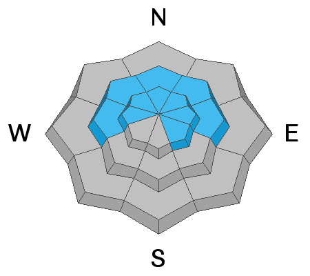
We have a conditionally unstable snowpack with strong snow over weak snow. This poor structure is on west to north to southeast facing terrain at the mid and upper elevations.
Avalanche frequency has diminished and audible collapsing/whumphing are less common. Snow tests are offering up mixed results.

I do, however, become concerned whenever there is another loading or stressing event on the snowpack such as heavy snowfall and/or significant winds and wind transported snow. Reports indicated yesterday that, despite the ferocious winds, there was not much transport. I would still approach our long suspect terrain with great caution today.
TREND: Slowly Decreasing Danger
Avalanche Problem #2
Wind Drifted Snow
Type
Location
Likelihood
Size
Description
Be on the lookout for a patchwork quilt of hard and stubborn wind drifts today. They'll be smooth and perhaps rippled and rounded and may be seemingly welded in unusual terrain. My expectation is that these hard wind slabs may still be triggered but it may be by the third person on the slope when it breaks out above them and not at their feet or machine.
Note that these drifts may be most prominent on north to east to south facing slopes but due to the strong winds and the effects of terrain channeling, the drifts may be on any aspect.
TREND: Decreasing danger
General Announcements
Please visit this website with information about Responsible Winter Recreation by the Utah Office of Outdoor Recreation.

This information does not apply to developed ski areas or highways where avalanche control is normally done. This forecast is from the U.S.D.A. Forest Service, which is solely responsible for its content. This forecast describes general avalanche conditions and local variations always occur.