Check out our Holiday Auction - Sign Up for the Utah Snow and Avalanche Workshop (USAW)

Forecast for the Ogden Area Mountains

Drew Hardesty
Issued by Drew Hardesty on
Tuesday morning, December 3, 2024
The danger for wet avalanches may rise to MODERATE today. When the snow becomes wet and unsupportable, it will be possible to either observe or trigger wet sluffs that can run long distances. In the upper elevation northwest through east facing slopes, areas of MODERATE danger exist for triggering a soft slab 1-2' deep that fails on a persistent weak layer of sugary, faceted grains.
Low
Moderate
Considerable
High
Extreme
Learn how to read the forecast here
Special Announcements
The 17th Annual Utah Snow and Avalanche Workshop (USAW) is scheduled for Saturday, December 7th. Information and tickets are available here.
Weather and Snow
Skies are mostly clear with light winds from the west. But it's the temperatures that have me worried. With the temperature inversion, we have warmer air aloft and overnight lows at many weather stations are in the upper 30s to low 40s. For some mid-elevations, this is the second night of a marginal refreeze.
For today, we'll have mostly clear skies with light winds from the west. Temperatures will again soar into the upper 40s to low 50s. Balmy. Sun and wind have taken their toll on our measly snowpack but one can find pockets of soft snow littered with surface hoar in the sheltered terrain. Snow depths are 1-2' on the shady aspects while many solar aspects have burnt down to the dirt.
The Outlook: Fairly grim. The next chance for any precipitation is late weekend with not much after that. We'll see.
Recent Avalanches
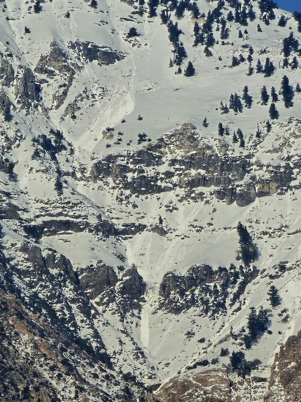
Long running wet loose avalanches were reported on the south and west side of Ben Lomond on Sunday, See GD's photo below. I would expect more of the same today.
Check out all of Ogden's recent Observations HERE.
Ad
Avalanche Problem #1
Wet Snow
Type
Location
Likelihood
Size
Description
It may be possible to trigger wet loose sluffs in steep terrain today on many aspects today. With today's temps and direct sun, the snow will become wet, unsupportable and punchy and it will be time to have wet avalanches on your radar. These wet loose sluffs will be enough to knock you off your feet and be dangerous, particularly in steep rocky terrain. Rollerballs and small point releases can be pre-cursors to wet, unstable snow.
Avalanche Problem #2
Persistent Weak Layer
Type
Location
Likelihood
Size
Description
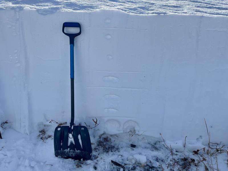
On mid and upper elevation shady aspects, you'll likely encounter a poor structure of strong-over-weak snow; the weak snow being sugary, faceted snow formed in early to mid-November. See McKinley Talty's photo from the Cutler Ridge on Saturday below. Although we have not heard of any avalanches triggered on this suspect layering in the Ogden mountains, there have been several triggered in the Salt Lake and Provo mountains, the most recent being on Saturday. Remember that cracking and collapsing are sure giveaways that things are dangerous. The most suspect terrain to trigger a 1-2' deep and 100' wide avalanche would be on these shady slopes and most prominently in any recently wind loaded terrain of the upper elevations.
General Announcements
This information does not apply to developed ski areas or highways where avalanche control is normally done. This forecast is from the U.S.D.A. Forest Service, which is solely responsible for its content. This forecast describes general avalanche conditions and local variations always occur.