Forecast for the Moab Area Mountains

Issued by Eric Trenbeath on
Saturday morning, March 7, 2020
Saturday morning, March 7, 2020
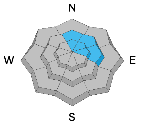
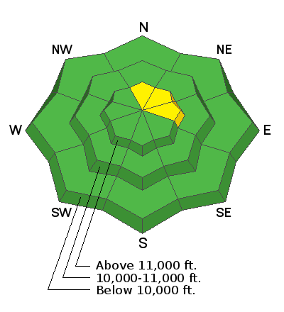
Most terrain has generally LOW danger but I feel there are enough isolated problem areas out there to warrant an overall MODERATE danger rating. Human triggered avalanches involving wind drifted snow and buried persistent weak layers of loose, sugary, faceted snow are still possible on steep, N-E facing slopes, particularly in areas of rocky, or more extreme terrain. Shallow areas near rock outcroppings or along slope margins are likely trigger points. Even a small avalanche triggered in the wrong area can have devastating consequences. And finally, with daytime heating, we may see some loose, wet avalanche activity on sun-exposed slopes. Avoid steep slopes if they become wet and sloppy.
Low
Moderate
Considerable
High
Extreme
Learn how to read the forecast here