Forecast for the Moab Area Mountains

Eric Trenbeath
Issued by Eric Trenbeath on
Wednesday morning, March 4, 2020
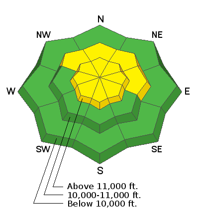
The avalanche danger remains MODERATE today with unstable areas of wind drifted snow being your primary concern. Look for fresh wind drifts on the lee sides of ridge crests and terrain features in upper elevation, wind exposed terrain. Fresh drifts are recognizable by their smooth, pillowy, or rippled appearance. It is also still possible to trigger loose snow avalanches on very steep slopes where the underlying snow surface is slick and hard. And finally, the new snow load has also created the potential for human triggered avalanches to step down into older weaker snow on steep, shady aspects. Be alert to signs of instability and approach all steep terrain with caution today.
Low
Moderate
Considerable
High
Extreme
Learn how to read the forecast here
Special Announcements
Road Conditions: Grand County plowed on Monday.
Grooming Report: Trails have not been groomed since the recent snow.
Weather and Snow
24 Hour Snow 0" Weekly Snow 13" Base Depth in Gold Basin 56" Wind NW 5-10 mph Temp 14F
Weather: The story is the wind. Though they are light now, NW winds yesterday blew in the 15-20 mph range along the highest ridgetops. By late afternoon they had ramped up into the 25 mph range with gusts into the 40's before finally backing off around midnight. Today look for sunny skies, light southerly winds and high temps in the upper 30's. Dry conditions remain through the week with what looks like a change in the pattern sometime this weekend.
Snowpack: Wind and sun have wrecked the powder party somewhat. Sun exposed slopes have developed a stout, breakable crust, and the wind has affected exposed northerly aspects but regardless, it sure is great to see a fresh coat of snow on things. Good powder conditions can still be found on shady, wind-sheltered terrain.
Underneath, the old snow surface consists of a variety of crusts and textures including hard slick surfaces for the most recent snow to slide off of. Near-surface faceting in sheltered areas has also provided a weak interface. In our travels yesterday we didn't experience any collapsing or see any avalanches that broke down into old snow, but with the underlying snowpack being so weak, I have to think there are areas where a human could trigger an avalanche down into the weak, sugary, faceted snow below.
Wind, temperature, humidity on Pre Laurel Peak (11,700')
Storm totals at Gold Basin Study Plot (10,000').
Snotel site near Geyser Pass Trailhead (9600').
Recent Avalanches
Wide spread avalanching within the new snow occurred during the storm with most of the steep, upper elevation N-E faces producing loose snow slides. A few fractures indicating soft slab avalanches were also observed. In our travels yesterday, we also witnessed one skier triggered loose snow avalanche on a steep, northerly aspect in a colouir around 11,000'.
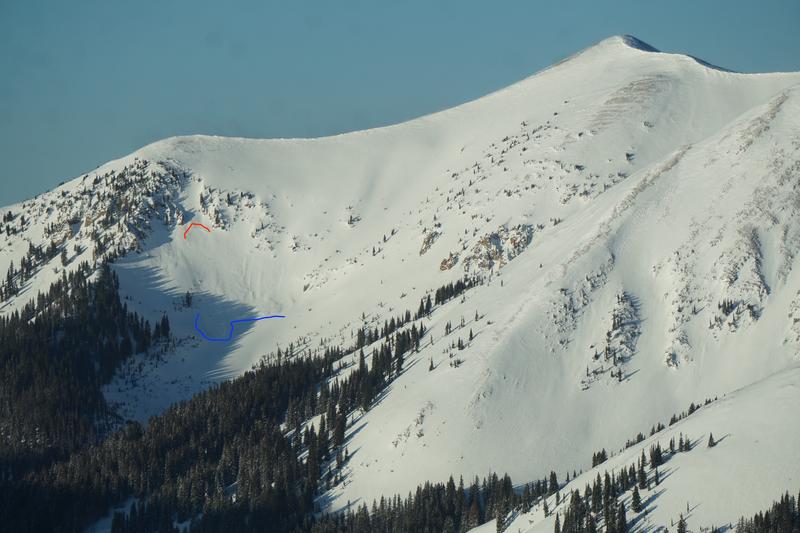
Aerial observer Chris Benson flew around yesterday and observed lots of loose avalanche activity from the storm on the north end of the range. Read his report with pictures here. He also observed this slab avalanche in Beaver Basin.
Ad
Avalanche Problem #1
Wind Drifted Snow
Type
Location
Likelihood
Size
Description
Moderate to strong northwest winds have blown and drifted snow in the upper elevations. Today, be on the lookout for fresh, unstable drifts along the leeward sides of ridge crests and terrain features and avoid steep slopes with smooth, pillowy looking deposits of wind drifted snow. Most of the snow has been deposited on slopes facing NE-SE-S, but cross-loading is also a factor on slopes with a westerly component. In some areas, a triggered wind slab may have the potential to step down into buried, weak, faceted snow causing a deeper and more dangerous avalanche.
Aerial observer Chris Benson shot this clip of active wind-loading yesterday.
Avalanche Problem #2
New Snow
Type
Location
Likelihood
Size
Description
Though growing more stable each day, the recent snow has landed on a variety of slick crusts and weak snow surfaces, and loose sluff avalanches remain possible on steep, upper elevation slopes facing N-NE-E, especially where the underlying surface is hard and slick.
Avalanche Problem #3
Persistent Weak Layer
Type
Location
Likelihood
Size
Description
Prior to the recent storm, the snowpack had deteriorated into a pile of non-cohesive loose, weak, sugary, facets. In some areas, crusts of varying strengths and thicknesses are overlying this weak snow, while in others, the snowpack was completely unsupportable. I'm uncertain to what extent the new load has affected the underlying weak snow, but the ante has been upped a bit, especially with the additional weight from wind loading. Until proven otherwise, I'm going to have to assume that the potential for human triggered avalanches involving buried weak snow exists. You are most likely to encounter this problem on steep, shady slopes facing NW-N-E.
General Announcements
Check out the avalanche beacon training park at the Geyser Pass Trailhead and practice your rescue skills!
This forecast is from the U.S. Forest Service, which is solely responsible for its content. This forecast describes general avalanche conditions and local variations always occur.