Forecast for the Moab Area Mountains

Eric Trenbeath
Issued by Eric Trenbeath on
Monday morning, March 2, 2020
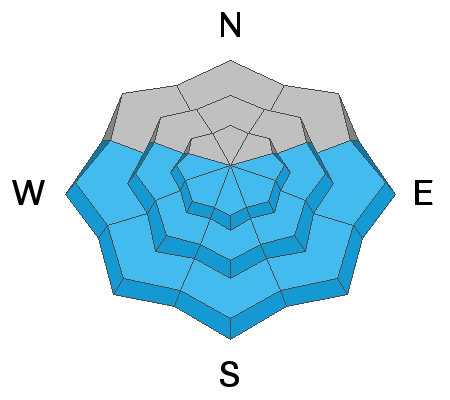
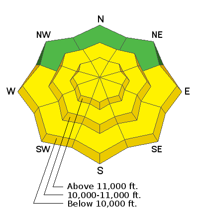
10" of new snow overnight has caused the avalanche danger to rise to MODERATE and human triggered soft slab and loose sluff avalanches will be possible on steep slopes on all aspects today. As the day heats up, the threat for loose, wet avalanches will rise on sun exposed slopes. Look for signs of instability such as roller balls, pin wheels, and actual loose, wet avalanches. Stay off of and out from under steep slopes as they become wet and sloppy.
Low
Moderate
Considerable
High
Extreme
Learn how to read the forecast here
Special Announcements
Road Conditions: Grand County will be plowing the road this morning. The gate will be locked while plowing is in progress.
Grooming Report: Trails are covered in fresh snow.
Weather and Snow
24 Hour Snow 10" Weekly Snow 13" Base Depth in Gold Basin UK Wind W 5-10 mph Temp 20F
Weather: I'm not one to believe in miracles but it appears we just experienced one! The Geyser Pass Trailhead Snotel is reporting 8" of new snow at .8" Snow Water Equivalent (SWE). Gold Basin is reporting 10" making this our biggest storm in weeks. Adding to the power of this great gift from the universe is the lack of wind which has been light and northwesterly since about 8:00 last night. Skies have cleared, and winds will remain light and westerly. High temps today will be near 30 degrees. The rest of the week looks dry and sunny.
Snowpack: Needless to say the new snow will greatly improve conditions. Underneath, however, the old snow surface consists of a variety of crusts and textures and you will still be able to feel this in some areas. Many surfaces are slick and hard and they will provide a good sliding surface for the new snow. Near-surface faceting in sheltered areas will also provide a weak interface. I don't think the new snow will provide enough of a load to break through crusts down into the older, weak facets, but this isn't a situation that should be ruled out.
Wind, temperature, humidity on Pre Laurel Peak (11,700')
Storm totals at Gold Basin Study Plot (10,000').
Snotel site near Geyser Pass Trailhead (9600').
Ad
Avalanche Problem #1
New Snow
Type
Location
Likelihood
Size
Description
The new snow has landed on a variety of slick crusts and weak snow surfaces, and both soft slab and loose sluff avalanches will be possible on steep slopes on all aspects today. Utilize test slopes and look for cracking in the snow surface as a sign of instability. Let the snow stabilize for a day or so before getting into steeper terrain.
Avalanche Problem #2
Wet Snow
Type
Location
Likelihood
Size
Description
The sun will hit the fresh snow today when it's most vulnerable, and you will need to be alert to the potential for loose, wet avalanches today. This danger will follow the sun. Look for signs of instability such as roller balls, pin wheels, and actual loose, wet avalanches. Stay off of and out from under steep slopes as they become wet and sloppy.
General Announcements
Check out the avalanche beacon training park at the Geyser Pass Trailhead and practice your rescue skills!
This forecast is from the U.S. Forest Service, which is solely responsible for its content. This forecast describes general avalanche conditions and local variations always occur.