We know there is a lot of uncertainty regarding the Coronavirus, but the Utah Avalanche Center is planning to continue issuing regular avalanche forecasts into April.
Road Conditions: Some snow and ruts exist on the upper portion of the road. Dirt and mud below.
Grooming: Trails were last groomed on Saturday.
24 Hour Snow 0" Weekly Snow 7" Base Depth in Gold Basin 56" Wind SE 30-35 G50 Temp 25F
Weather: Clouds are moving in and southerly winds are cranking as a low-pressure storm system moves into the region. There are some model discrepancies with this one and snow totals are uncertain but we should see showers develop this afternoon with 1"-3" possible. Southerly winds will continue to blow in the 20-30 mph range with gusts in the 40's. High temps will be in the low 30's. Snow should pick up tonight and linger through tomorrow. It looks like about 4"-8" when it's all said and down.
Snowpack: It's a mixed bag out there both above and below. The snow surface has a variety of conditions ranging from wind-scoured to sun crusted. Some soft snow remains in sheltered areas. Areas of wind drifted snow exist above treeline, primarily on northerly aspects and in some cases, these drifts are overlying weak, sugary, faceted snow. In shady, shallow snowpack areas, the underlying snowpack is comprised almost entirely of loose, facets.
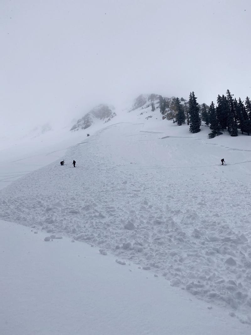
A party of tourers triggered a significant avalanche Saturday on a steep, NE aspect around 11,000' in upper Gold Basin. Though wind drifted snow was the primary problem, it did propagate into a layer of weak, faceted snow. Human triggered avalanches such as this remain possible today. Here is a
report from Dave Garcia who spoke with the party involved.