Forecast for the Moab Area Mountains

Eric Trenbeath
Issued by Eric Trenbeath on
Monday morning, March 16, 2020
The avalanche danger is a solid MODERATE today for a variety of problems. 1) Human triggered avalanches involving wind drifted snow remain highly possible on steep slopes right around treeline and above that face NW-N-E. 2) In some of these same areas, you may be able to trigger a deeper avalanche on a buried persistent weak layer of loose, sugary, faceted snow. 3) With a strong sun and warming temps, the danger for loose wet avalanche activity will rise on steep, sun-exposed slopes. Be alert to signs of instability such as roller balls and pinwheels, and stay off of steep slopes that become wet and sloppy. Tune your avalanche awareness up today, and tune down your expectations.
Low
Moderate
Considerable
High
Extreme
Learn how to read the forecast here
Special Announcements
We know there is a lot of uncertainty regarding the Coronavirus, but the Utah Avalanche Center is planning to continue issuing regular avalanche forecasts into April.
Road Conditions: Some snow and ruts exist on the upper portion of the road. Dirt and mud below.
Grooming: Matt from LUNA groomed on Saturday.
Weather and Snow
24 Hour Snow T" Weekly Snow 7" Base Depth in Gold Basin 56" Wind S 20-25 G30 Temp 28F
Wind, temperature, humidity on Pre Laurel Peak (11,700')
Storm totals at Gold Basin Study Plot (10,000').
Snotel site near Geyser Pass Trailhead (9600').
NWS weather forecast.
Weather: Look for mostly sunny skies this morning with increasing clouds later today. Southerly winds will continue to blow in the 15-20 mph range with gusts into the 30's. High temps will rise up into the low 40's. Dry and breezy conditions continue through tomorrow followed by the next Pacific low-pressure system that will begin tracking across the desert southwest on Wednesday.
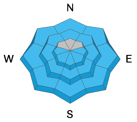
Snowpack: I went up yesterday to have a look at Sunday's skier triggered avalanche. On my way in I experienced a few collapses in shallow areas where a new slab has formed over an existing structure that is comprised almost entirely of weak, sugary, faceted snow. The avalanche initiated as a wind slab failing at the old snow surface but it gouged and propagated into facets along the slope margins. The snowpack is variable and complex out there right now. Fresh drifts formed on leeward slopes overly surfaces ranging from hard, smooth and relatively strong to loose and weak. Windward slopes are mostly scoured and exposed surfaces are firm. Travis Nauman and company were also out yesterday where they observed a poor snowpack structure on a mid-elevation, westerly aspect. Read their observation here.
The new snow has improved things and decent turning conditions can be found on sheltered, northerly facing terrain. Brief periods of sun yesterday afternoon touched some exposed slopes and they will likely be crusted over today.
Recent Avalanches
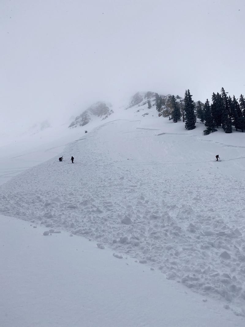
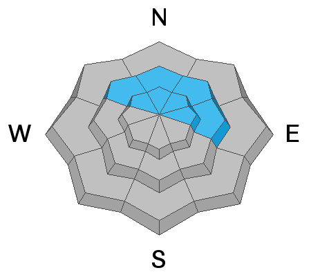
A party of tourers triggered a significant avalanche Sunday on a steep, NE aspect around 11,000' in upper Gold Basin. Though wind drifted snow was the primary problem, it did propagate into a layer of weak, faceted snow. Human triggered avalanches such as this remain possible today. Here is a report from Dave Garcia who spoke with the party involved.
Ad
Avalanche Problem #1
Wind Drifted Snow
Type
Location
Likelihood
Size
Description
Strong southerly winds have blown and drifted snow forming fresh drifts on northerly aspects right around treeline and above. Avoid steep slopes that have a smooth, rounded appearance and look for signs of instability such as cracking in the snow surface. In some areas, a triggered wind slab could step down into a buried persistent weak layer causing a deeper and more dangerous avalanche.
Avalanche Problem #2
Persistent Weak Layer
Type
Location
Likelihood
Size
Description
Recent and wind drifted snow has provided enough of a load to affect the layers of weak, sugary, faceted snow that comprises much of the snowpack. You are most likely to trigger an avalanche involving these persistent weak layers on steep, wind loaded, northerly facing slopes right around treeline. Shallow snowpack areas around rocks or along slope margins are likely trigger points.
Avalanche Problem #3
Wet Snow
Type
Location
Likelihood
Size
Description
Cloud cover and wind yesterday kept things cool with only brief periods of sunshine. This gradual warming will make the most recent snow less vulnerable to the effects of the sun today. Nevertheless, with temps soaring into the mid 40's today, the danger for loose, wet, avalanche activity will rise on sun-exposed slopes. Watch for signs of instability such as rollerballs or pinwheels and stay off of steep slopes as they become wet and sloppy.
General Announcements
Check out the avalanche beacon training park at the Geyser Pass Trailhead and practice your rescue skills!
This forecast is from the U.S. Forest Service, which is solely responsible for its content. This forecast describes general avalanche conditions and local variations always occur.