Forecast for the Moab Area Mountains

Issued by Eric Trenbeath on
Tuesday morning, February 4, 2020
Tuesday morning, February 4, 2020
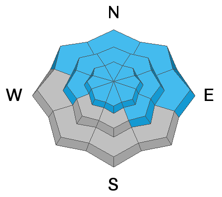
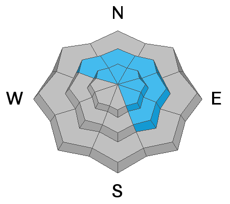
Blowing and drifting of the recent snow has created a CONSIDERABLE avalanche danger, and human triggered avalanches are likely on steep, wind drifted slopes. Most drifting has occurred on slopes facing the north side of the compass, but with the strong and gusty nature of the winds, you may find areas of unstable wind drifted snow on all aspects. On most south-facing terrain you will find a MODERATE avalanche danger. Wind drifts are recognizable by their smooth, rounded, or rippled appearance, and cracking is a sign of instability. In areas where the underlying snowpack is shallow and weak, a triggered wind slab may step down to a buried persistent weak layer causing a deeper and more dangerous avalanche. Avoid steep, wind drifted slopes today.

Low
Moderate
Considerable
High
Extreme
Learn how to read the forecast here