Check out our Holiday Auction - Sign Up for the Utah Snow and Avalanche Workshop (USAW)

Forecast for the Moab Area Mountains

Eric Trenbeath
Issued by Eric Trenbeath on
Wednesday morning, December 14, 2022
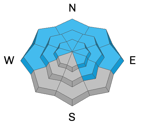
Accumulating and wind drifted snow has kept the avalanche danger at CONSIDERABLE on steep slopes that face W-N-SE and dangerous, human triggered avalanches, failing on a buried persistent weak layer 2'-4' deep are likely. Slopes steeper than 30 degrees should be avoided in this terrain.
Up to 20" of new snow has fallen since Monday and a MODERATE danger remains for triggering soft slabs, or loose sluffs on all aspects at all elevations. Exercise caution in steep terrain and avoid terrain traps.
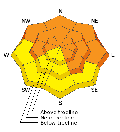
Low
Moderate
Considerable
High
Extreme
Learn how to read the forecast here
Special Announcements
Road Conditions: Grand County plowed yesterday.
Grooming: Matt and Dave got after it yesterday and groomed the entire mountain from Gold Basin through Geyser Pass. Thanks guys!
Weather and Snow
24 Hour Snow 5" 72 Hour Snow 19" Season Total Snow 74" Base Depth at Gold Basin 45"
Winds on Pre Laurel Peak NW 5-10 Temp 6F
Weather
The gift storm that just kept giving has moved on leaving us under a cold northwesterly flow. Dress warm and it will be a beautiful day up there today. Skies will be mostly sunny with high temps in the mid teens. Light NW winds will cause wind chill values to be well below zero. We should see a few clouds tonight from a passing weak shortwave followed by dry conditions into next week.

General Conditions
We're now up to almost 20" of new snow at just over an 1.5" of water this week. Cold temperatures and light winds have preserved the snow and conditions will be excellent today, but all of this new snow has fallen on top of a very poor snowpack structure. The entire snowpack beneath the November 28 storm is loose, weak, and faceted. In short, incremental loading from new and drifted snow this week has made today's dangerous, a little more dangerous than yesterday's, and human triggered avalanches remain likely.

Snowpack and Weather Data
Gold Basin Storm Stake (10,000')
Gold Basin SNOTEL site (10,000')
SNOTEL site near Geyser Pass Winter Trailhead (9600')
Wind Station on Pre-Laurel Peak (11,400')
NWS forecast for the La Sal Mountains.
Click here for a list of recent observations. If you're getting out in the backcountry please let us know what you are seeing by submitting observations here.
Ad
Avalanche Problem #1
Persistent Weak Layer
Type
Location
Likelihood
Size
Description
A persistent weak layer of faceted snow that developed during the cold dry period in mid November is now present on aspects that face W-N-SE. Recent and wind drifted snow has incrementally loaded this weak layer and we are in a tentative state. Outward signs of instability may not be present, but audible collapses and shooting cracks are sure signs that the buried weak layer is failing under the weight of the new snow. This condition is most dangerous and wide spread on slopes facing NW-N-E, where wind drifted snow has built thick slabs on top. These hard slabs are 1-4' thick and can produce very large, deep, and potentially deadly avalanches. The only good strategy right now is to avoid slopes steeper than 30 degrees that face W-N-SE.
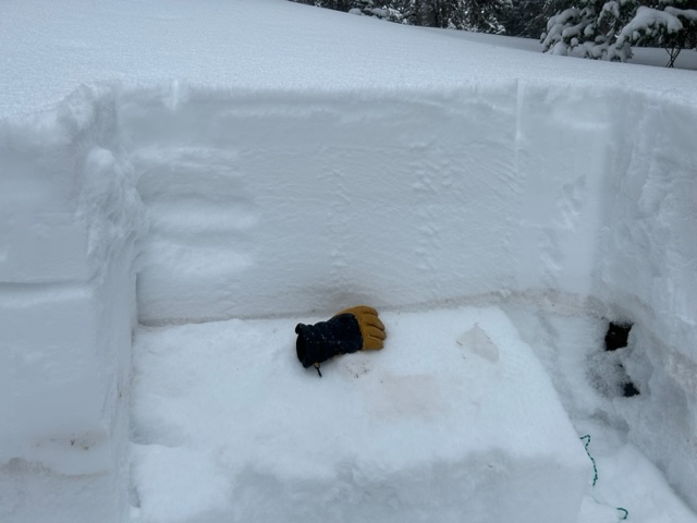
The buried weak layer sits right behind my glove in this photo. If you dig down, it is easy to locate because of the brown dust in the layer.
Avalanche Problem #2
New Snow
Type
Location
Likelihood
Size
Description
In his travels on Monday, Dave Garcia experienced unstable storm snow with failure occurring at the new/old snow interface. This type of instability typically settles out within a day or so, but the snow has continued to fall and we now have up to 20" of recent snow on top of the old snow surface. Continue to suspect human triggered avalanches within the snow, especially if you are headed to south facing terrain to avoid persistent weak layer problems. Skier triggered soft slabs or sluffs can pick up speed quickly and run long distances. Be cautious on steep slopes, and avoid terrain traps.
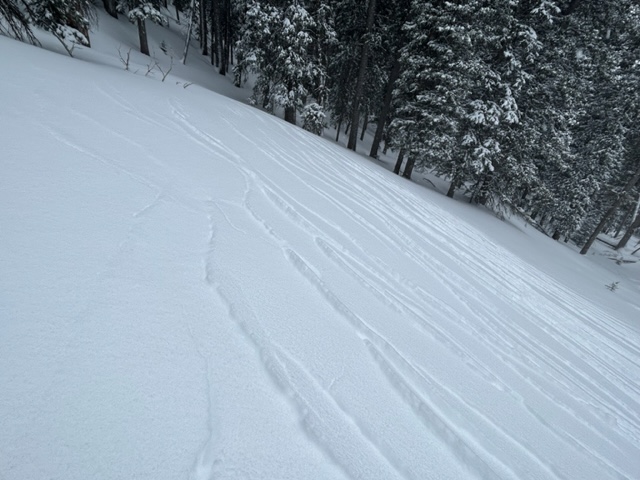
Cracking in the storm snow indicates unstable conditions.
Additional Information
General Announcements
This forecast is from the U.S.D.A. Forest Service, which is solely responsible for its content. This forecast describes general avalanche conditions and local variations always occur. This forecast will be updated by 7:30 tomorrow morning.