Check out our Holiday Auction - Sign Up for the Utah Snow and Avalanche Workshop (USAW)

Forecast for the Moab Area Mountains

Dave Garcia
Issued by Dave Garcia on
Tuesday morning, December 13, 2022
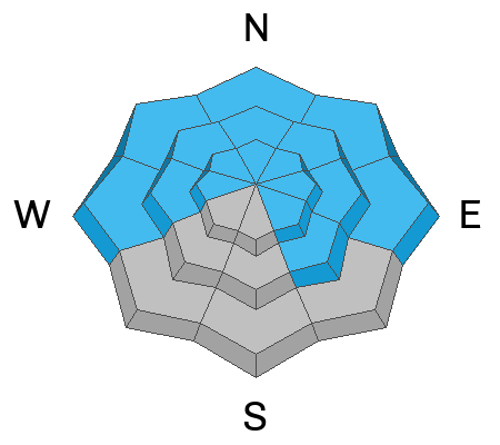
A quick hitting storm has created a CONSIDERABLE avalanche danger on steep slopes that face NW-N-E near treeline and above. Previous wind drifting has created thick hard slabs in these zones and dangerous, human triggered avalanches, failing on a buried persistent weak layer 1'-4' deep are likely. Slopes steeper than 30 degrees should be avoided in this terrain. Slopes that face W and SE with similar layering have a MODERATE danger and human triggered avalanches are possible.
14" of storm snow has created a MODERATE danger for triggering dry loose avalanches or skier triggered sluffs on all aspects at all elevations. Exercise caution in steep terrain and avoid terrain traps.
Low
Moderate
Considerable
High
Extreme
Learn how to read the forecast here
Special Announcements
Road Conditions: Grand County will be plowing the Geyser Pass Road today. Expect the gate to be closed for the morning.
Grooming: The Geyser Pass Road above the winter trailhead closes on Dec 15. Grooming will commence after that.
Weather and Snow
24 Hour Snow 10" 72 Hour Snow 14" Season Total Snow 69" Base Depth at Gold Basin 45"
Winds on Pre Laurel Peak WNW 5-10 Temp 6F
Weather
The center of the low pressure system has moved into Colorado leaving us with cold temperatures and winds out of the NW. Temperatures will remain in the single digits at 10,000 ft today. NW winds will blow 10-15 mph and wind chill values will be sub zero. As the low exits we will see mostly cloudy skies and a lingering chance of snow showers later this afternoon into the evening. The main event is over, but we could pick up another 1-2 inches by tonight.

General Conditions
A quick moving storm has left us with 14" of new snow at 1.1" of water. The skiing was excellent yesterday and will be even better today. Cold temperatures will preserve the cold dry powder and make for stellar conditions. A poor snowpack structure still exists however, and the entire snowpack beneath the November 28 storm is loose, weak, and faceted. Incremental loading from new and drifted snow will keep us in a dangerous state where the signs of instability aren't obvious but the danger is slightly elevated. On wind drifted northerly aspects, slabs 1'-4' thick exist over this weak, faceted layer and deep and dangerous, human triggered avalanches are likely in these areas.

Snowpack and Weather Data
Gold Basin Storm Stake (10,000')
Gold Basin SNOTEL site (10,000')
SNOTEL site near Geyser Pass Winter Trailhead (9600')
Wind Station on Pre-Laurel Peak (11,400')
NWS forecast for the La Sal Mountains.
Click here for a list of recent observations. If you're getting out in the backcountry please let us know what you are seeing.
Ad
Avalanche Problem #1
Persistent Weak Layer
Type
Location
Likelihood
Size
Description
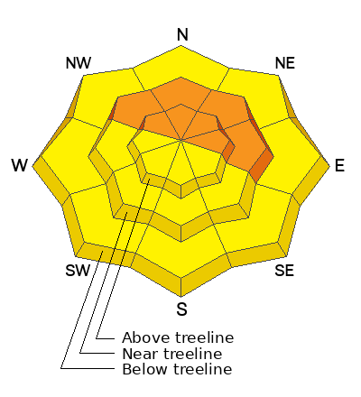
A persistent weak layer of faceted snow that developed during the cold dry period in mid November is now present on aspects that face W-N-SE. A fresh load of 14" of snow may be enough to wake up this PWL and produce avalanche activity today. Audible collapses and shooting cracks are sure signs that the buried weak layer is failing under the weight of the new snow. This condition is most dangerous and wide spread on slopes facing NW-N-E, where wind drifted snow has built thick slabs on top. These hard slabs are 1-4' thick and can produce very large, deep, and potentially deadly avalanches. Fresh wind drifts formed on these slopes again yesterday during the storm. A slide triggered in a fresh drift can step down and trigger one of these larger more dangerous avalanches. Avoid slopes steeper than 30 degrees that face W-N-SE.
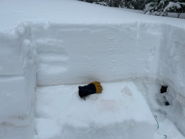
The buried weak layer sits right behind my glove in this photo. If you dig down, it is easy to locate because of the brown dust in the layer.
Avalanche Problem #2
New Snow
Type
Location
Likelihood
Size
Description
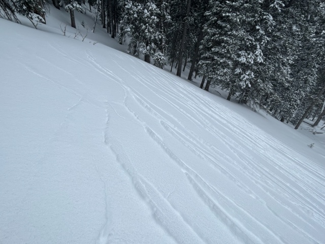
In my travels yesterday I experienced unstable storm snow and I observed a good amount of cracking in the new snow. Failure was occurring at the new/old snow interface and the new snow was poorly bonded to the old surface snow. New snow instabilities will remain a concern today with an additional five inches last night. Human triggered dry loose snow avalanches will be possible in steep terrain today. Skier triggered sluffs on steep slopes can pick up speed quickly and run long distances. Be cautious on steep slopes, and avoid terrain traps.
Cracking in the storm snow indicates unstable conditions.
Additional Information
General Announcements
This forecast is from the U.S.D.A. Forest Service, which is solely responsible for its content. This forecast describes general avalanche conditions and local variations always occur. This forecast will be updated by 7:30 tomorrow morning.