The road has not been plowed and multiple vehicles were stuck yesterday. I expect plowing will happen on Monday.
The First Annual Avalanche Awareness Week is December 2-7 We have a week full of fun and educational events planned. Check out the schedule
here.
The annual free Know Before You Go avalanche awareness talk will be held at the Grand County Library on Thursday, Dec 5 at 6:00 p.m. Hope to see you there!
After one of the driest falls on record, November has gone out white! Up to 60" of snow has fallen over the past week and it is truly a best-case scenario. A week before we received 8"-15" of dense, wet snow, and the ground was dry prior to that. Unlike last season when we had a layer of weak, faceted snow on the ground by now, we are currently stacking up fairly strong with avalanche problems confined to new and drifted snow. I haven't been able to get around into the high country yet due to access issues, first - not enough snow, second - too much, but I will get up there this week and have a good look around. Caution is still required as there are rocks and logs lurking below the surface but generally speaking, it's game on!
It's going to be a beautiful day in the mountains with high temps in the upper 20's and light NW winds. We'll see dry conditions through Tuesday with our next chance for snow coming in Wednesday.
Pre-Laurel has been rimed up for the past couple of days. I'll get to it after they plow or it may melt out.
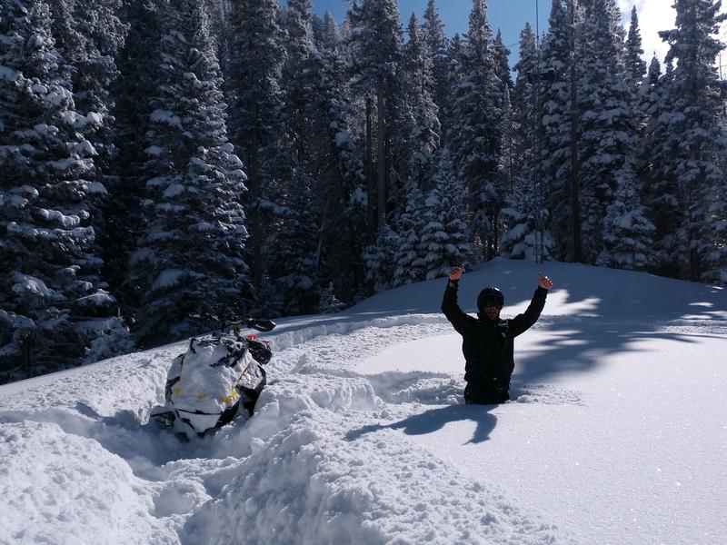
Chris Jacobsen went up to Geyser yesterday and confirmed that it was deep!
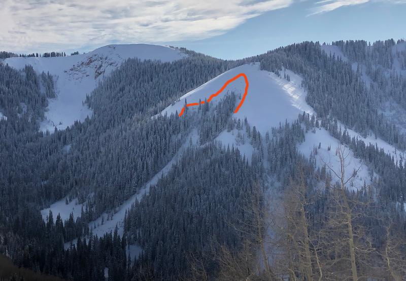
Meanwhile, in Miner's Basin...
We observed this natural avalanche from afar in Miner's Basin. It's on a NE aspect at 10,700'. It looked to be about 3' deep and measured about 175' wide. Not something you would want to be involved with.