Check out our Holiday Auction

Forecast for the Logan Area Mountains

Toby Weed
Issued by Toby Weed on
Friday morning, December 23, 2022
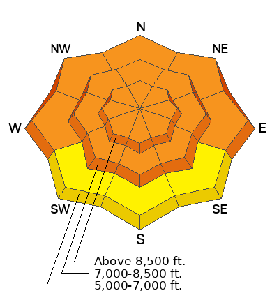
There is CONSIDERABLE danger on drifted slopes across the zone at all elevations, including on drifted lower and mid elevation slopes with poor snow structure. Wednesday's windy storm changed the snow landscape in many areas, and created dangerous and complex avalanche conditions. People are likely to trigger dangerous slab avalanches of wind drifted snow failing on a buried persistent weak layer. Avalanches could be triggered remotely, from a distance, or below, and these could be 2 to 4 feet thick and a few hundred feet wide.
Careful snowpack evaluation, cautious route-finding, and conservative decision making are essential for safe backcountry travel today.
Low
Moderate
Considerable
High
Extreme
Learn how to read the forecast here
Special Announcements
As the end of the year approaches, please consider a donation to the UAC to support avalanche forecasting.
Weather and Snow
Dangerous conditions exist because Wednesday's extremely strong winds drifted tons of snow and created thick slabs overloading slopes with buried sugary persistent weak layers.

This morning: Snowfall is visible on Beaver Mountain's Webcams and temperatures climbed overnight into the upper teens. Winds diminished significantly by yesterday morning, and it's fairly calm again this morning at the Logan Summit weather station, where crazy up-canyon winds were gusting in the 70 mph range for much of the day Wednesday. I'm reading 17° F at the 8400' Tony Grove Snotel, which reports 50 inches of total snow.
Today snow showers are likely and it will be cloudy, with 8500' high temperatures near 25° F. West winds will blow 8 to 11 mph with gusts in the 20s and wind chill values will be as low as -1° F. Around an inch of accumulation is possible.
Tonight, snow showers will continue with 2 to 4 inches possible. Temperatures will climb to around 23° F by morning, and west-southwest winds will blow around 10 mph.
Tomorrow will be cloudy and snow showers are likely, but accumulations will be light. 8500' high temperatures will be around 29° F, with 10 mph west winds.
The weather for the Christmas weekend looks unsettled and somewhat cloudy, and the next chance for significant storminess and accumulating snow will begin to effect the Logan Zone on Tuesday
Recent Avalanches
Natural avalanches were fairly widespread during Wednesday's stormy weather. A party reported remotely triggering an avalanche of wind drifted snow in Cherry Creek Canyon, and there was activity in the backcountry on the backside of Beaver Mountain and near Hwy 89 in Logan and Beaver Canyons. Evidence of several large natural avalanches could be seen with clearing Thursday in the Wellsville Mountain Wilderness and in the Mount Naomi Wilderness, and a good sized natural avalanche occurred just above Mahogany Drive in Garden City.

***See our updated list of observed avalanches from the Logan Zone HERE and from across Utah HERE
Ad
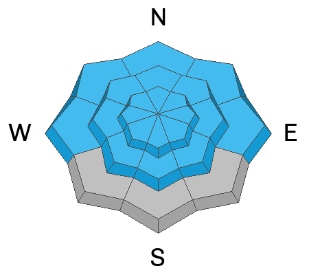
Avalanche Problem #1
Persistent Weak Layer
Type
Location
Likelihood
Size
Description
In areas where the snow is shallow, less than about 3 feet deep, the basal layers of the snowpack are very loose and sugary. If you get off your sled or skis you sink all the way to the ground and it's pretty easy to get the sled stuck if you sink and spin your track into the bottomless sugary snow. Avalanches failing on a buried persistent weak layer are most likely on slopes with significant recent accumulations of wind drifted snow.
  • Sugary or faceted November snow makes up the most widespread PWL in the zone, but there is another now, consisting of feathery surface hoar or small grained near surface facets that was on the snow surface before Wednesday's storm.
  • Red Flags indicating a persistent weak layer instability will include audible collapses or whumpfs and shooting cracks, but sometimes no red flags are apparent, and you have to dig down into the snow to find the sugary weak layer.
  • Slab avalanches failing on a buried persistent weak layer could be remotely triggered from a distance, and hopefully not from below.
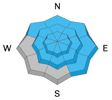
Avalanche Problem #2
Wind Drifted Snow
Type
Location
Likelihood
Size
Description
Avalanches of wind drifted snow are likely for people to trigger in recently drifted terrain at all elevations.
  • Slabs of drifted snow formed on the lee side of major ridges, under cornices, and in and around terrain features like sub-ridges, saddles, cliff bands, and gully walls.
  • The drifting built both hard and soft slabs of wind drifted snow on slopes with buried persistent weak layers, creating poor snow structure. Softer wind slabs can be very sensitive and are often remotely triggered, while harder slabs are often much more stubborn, sometimes waiting for a person to get well out on them before releasing suddenly like a giant mouse trap.
  • We plan to continue to stay off of and out from under all recently drifted slopes in the backcountry steeper than about 30°.
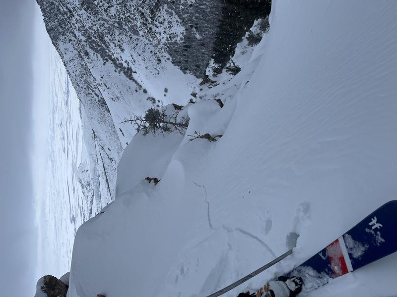
Shooting cracks in wind drifted snow like this are a sure sign of instability.
Additional Information
Take the all-new online avalanche courses the UAC built for Know Before You Go or take other online courses listed on the KBYG website (Develop skills -> Online Learning).
Remember, when you leave the ski area boundary, Beaver Mt or Cherry Peak, you are entering the backcountry, and you could trigger dangerous avalanches....
  • Put fresh batteries in your transceiver and inspect your shovel and probe.
  • Practice Companion Rescue with your backcountry partners.
General Announcements
Please submit your observations from the backcountry HERE.
For a list of avalanche classes from the Utah Avalanche Center go HERE
For information on where you can ride your sled or snowbike, check out this map of the winter travel plan for the Tony Grove and Franklin Basin Areas HERE.
This forecast is from the U.S.D.A. Forest Service, which is solely responsible for its content. This forecast describes general avalanche conditions and local variations always occur.