Join us at our 2nd Annual Blizzard Ball

Forecast for the Logan Area Mountains

Toby Weed
Issued by Toby Weed on
Tuesday morning, December 20, 2022
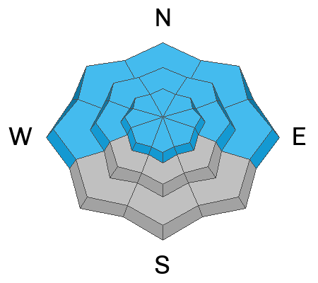
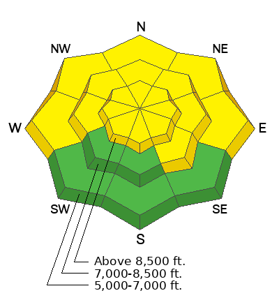
Elevated avalanche conditions and MODERATE danger exist in the backcountry. Dangerous avalanches remain possible on many slopes steeper than 30° and might be triggered remotely, from a distance, or below! Heavy snow and drifting from a winter storm will cause rising avalanche danger and increasingly dangerous conditions in the next couple days.
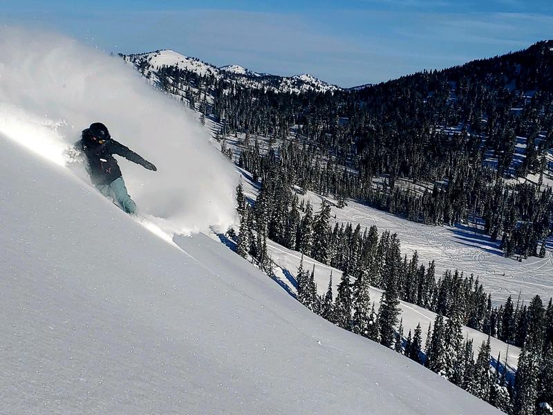
The danger is LOW on southerly facing low and mid elevation slopes, and we've found areas with great powder riding in sheltered areas and in safe lower angled terrain.

Evaluate snow and terrain carefully.
Low
Moderate
Considerable
High
Extreme
Learn how to read the forecast here
Special Announcements
  • As the end of the year approaches, please consider a donation to the UAC to support avalanche forecasting.
  • We have discounted Beaver Mountain tickets for sale. HERE. Huge thanks to Beaver Mountain for supporting the work we do.
Weather and Snow
Avalanche conditions are elevated on most slopes steeper than 30°. Last week, heavy snow and drifting overloaded many slopes plagued by buried weak layers and poor snow structure. Backcountry observations continue to include reports of audible collapsing or "whumpfs". These collapses could produce dangerous avalanches in steeper terrain.

This morning winds from the southwest are blowing 25 to 30 mph and gusting into the 40s at the 9700' CSI Logan Peak weather station. I'm reading 22° F and there is 45 inches of total snow at the 8400' Tony Grove Snotel.
Today expect increasing clouds and blustery southwest winds. Some snow is likely in the afternoon, but not much accumulation is expected. 8500' high temperatures will be around 23° F, and 15 to 20 mph southwest winds with gusts in the 30s will create wind chill values as low as -1° F.
Tonight snowfall could be heavy at times, and there will be areas with blowing snow, with gusty west winds and 4 to 8 inches of accumulation on upper elevation slopes.
Tomorrow will be quite stormy, with periods of heavy snow and significant drifting from stronger west winds blowing 25 to 35 mph with gusts well above 50 mph possible. 6 to 10 inches of accumulation is likely on upper elevation slopes. The avalanche danger is likely to climb to HIGH by tomorrow afternoon as slopes with poor snow structure are overloaded once again.
Recent Avalanches
Natural avalanches were fairly widespread during the stormy weather last week. No new avalanches or avalanche incidents were reported from the weekend.

***See our updated list of observed avalanches from the Logan Zone HERE and from across Utah HERE
Ad
Avalanche Problem #1
Persistent Weak Layer
Type
Location
Likelihood
Size
Description
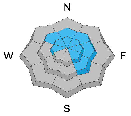
We've found buried layers of sugary snow at all elevations and on slopes facing every direction. In areas where the snow is shallow, < about 3 feet deep, the basal layers of the snowpack are very loose and sugary. If you get off your sled or skis you sink all the way to the ground and it's pretty easy to get the sled stuck if you sink and spin your track into the bottomless sugary snow. This set up is not good, and conditions will become worse this week as heavy snow and drifting overload slopes plagued by the widespread persistent weak layer.
  • Red Flags indicating a persistent weak layer instability will include audible collapses or whumpfs and shooting cracks, but sometimes no red flags are apparent, and you have to dig down into the snow to find the sugary weak layer.
  • Slab avalanches failing on a buried persistent weak layer could be remotely triggered from a distance, and hopefully not from below.
Avalanche Problem #2
Wind Drifted Snow
Type
Location
Likelihood
Size
Description
Recent and ongoing drifting overloaded slopes with buried persistent weak layers, built stiffer slabs, and elevated avalanche conditions. People could trigger dangerous avalanches of wind drifted snow in exposed upper and mid elevation terrain. Avalanches of wind drifted snow failing on a buried persistent weak layer could be 2 to 4 feet deep and a few hundred feet wide.
  • Slabs of drifted snow formed and are still building on the lee side of major ridges, under cornices, and in and around terrain features like sub-ridges, saddles, cliff bands, and gully walls.
  • Our plan is to continue to stay off of and out from under all recently and previously drifted slopes in the backcountry steeper than about 30°.
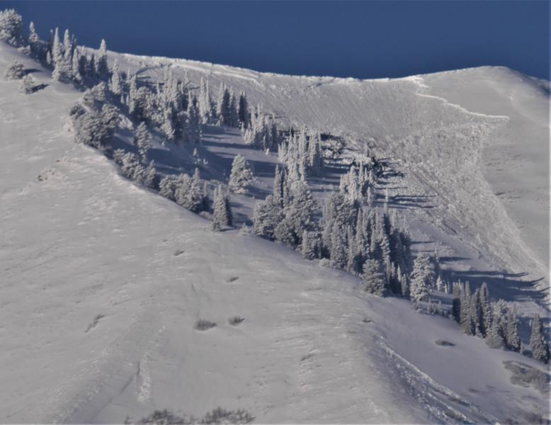
A recent natural avalanche consisting of wind drifted snow in Gibson Canyon in the Wellsville Mountain Wilderness is visible in the mornings from across Cache Valley.
Additional Information
Despite continued collapsing, recent natural avalanches, and poor snow test results, the danger of triggering an avalanche on a buried persistent weak layer is gradually moderating. Check out Eric's recent blog about Moderate danger with a persistent weak layer problem HERE.
Backcountry riders are finding great powder conditions in sheltered terrain, but with the next winter storm on our doorstep we can expect rapidly rising avalanche danger.
Take the all-new online avalanche courses the UAC built for Know Before You Go or take other online courses listed on the KBYG website (Develop skills -> Online Learning).
Remember, when you leave the ski area boundary, Beaver Mt or Cherry Peak, you are entering the backcountry, and you could trigger dangerous avalanches....
  • Put fresh batteries in your transceiver and inspect your shovel and probe.
  • Practice Companion Rescue with your backcountry partners.
General Announcements
Please submit your observations from the backcountry HERE.
For a list of avalanche classes from the Utah Avalanche Center go HERE
For information on where you can ride your sled or snowbike, check out this map of the winter travel plan for the Tony Grove and Franklin Basin Areas HERE.
This forecast is from the U.S.D.A. Forest Service, which is solely responsible for its content. This forecast describes general avalanche conditions and local variations always occur.