Join us at our 2nd Annual Blizzard Ball

Forecast for the Logan Area Mountains

Toby Weed
Issued by Toby Weed on
Tuesday morning, December 17, 2024
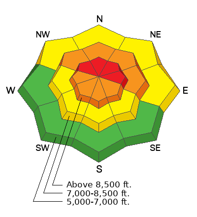
The avalanche danger is HIGH today at upper elevations in the northern half of the Logan Zone. Natural and human-triggered avalanches of wind-drifted snow are likely on drifted slopes facing northwest through east. There is CONSIDERABLE danger on many upper and mid-elevation slopes, and people are likely to trigger 1 to 3-foot-thick soft slab avalanches of drifted storm snow.
  • Heavy new snow and drifting by strong winds from the west are overloading widespread, very weak, faceted snow.
  • Avalanches could be triggered remotely (from a distance) or from below!
  • There is less danger at lower elevations and in sunny terrain that had shallow snow or was bare last week.
People should avoid traveling in upper-elevation avalanche terrain and stay clear of obvious or historic avalanche paths today. Stay off and out from under drifted slopes steeper than 30°
Low
Moderate
Considerable
High
Extreme
Learn how to read the forecast here
Special Announcements
Gear up for the season or score great deals on gifts for loved ones this holiday season while supporting the UAC’s efforts. Your participation directly funds the state's avalanche forecasting, awareness, and education programs. Check out the auction found here!
Weather and Snow
Avalanche conditions are dangerous due to heavy snowfall and continued drifting by strong winds. In exposed terrain at upper elevations, drifting snow is overloading slopes with weak faceted snow. Upper elevation slopes in the Central Bear River Range picked up about 8 inches of heavy new snow overnight and solid foot over the weekend, with the Tony Grove Snotel reporting around 3 inches of SWE (Snow Water Equivalent.) All the new snow plus consistent strong westerly winds have created dangerous avalanche conditions. With an exceptionally weak snowpack, natural and human-triggered avalanches are likely in steep, wind-loaded terrain. Conditions are less dangerous on low elevation and sunny slopes that had very shallow snow cover or were bare before last weekend's storm.
-The Tony Grove Snotel at 8400 feet above sea level reports 26° F, with about 8 inches of new snow, and 34 inches of total snow.
-Winds on Logan Peak are blowing from the west around 25 mph with gusts up to 54 mph early this morning.
-It's 24° F at Card Canyon with about 5 inches of new snow and 31 inches of total snow.
-On Paris Peak at 9500 feet its 19° F with west-southwest winds blowing 16 to 20 mph with gusts near 30 mph.
This is the NWS point forecast for Naomi Peak Area:
Today: Snow, mainly before 2pm. The snow could be heavy at times. High near 27. Wind chill values as low as 10. West wind 16 to 20 mph. Chance of precipitation is 90%. Total daytime snow accumulation of 3 to 7 inches possible.
Tonight: A 20 percent chance of snow before 8pm. Mostly cloudy, with a steady temperature around 21. Wind chill values as low as 7. West wind 9 to 11 mph.
Wednesday: Mostly sunny, with a high near 33. Wind chill values as low as 7. Breezy, with a west wind 13 to 18 mph increasing to 19 to 24 mph in the afternoon. Winds could gust as high as 37 mph.
For more information, visit the UAC weather page here: Weather - Utah Avalanche Center
For Logan-specific weather, go here: Logan Mountain Weather - Utah Avalanche Center
Recent Avalanches
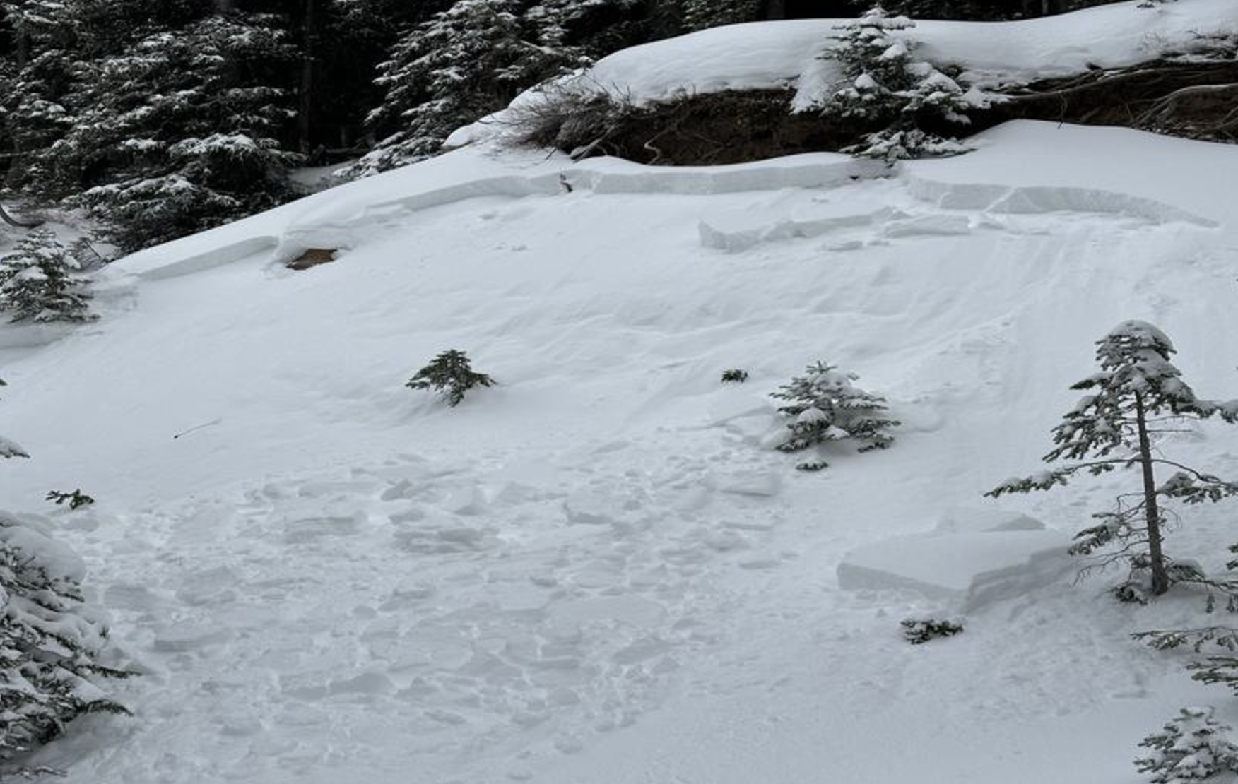
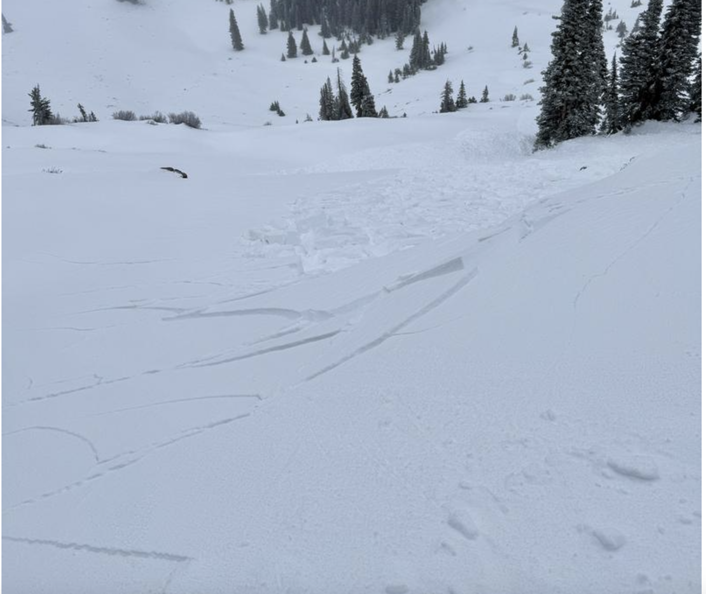
There were a handfull of natural avalanches reported from overnight Saturday night or early Sunday morning. Several remotely triggered avalanches also occurred Sunday. These were all less than about a foot deep and were generally contained by terrain features.
You can read all recent local observations here.
Ad
Avalanche Problem #1
Wind Drifted Snow
Type
Location
Likelihood
Size
Description
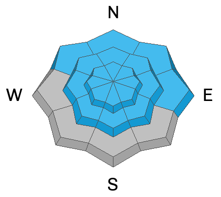
With sustained strong winds and heavy snowfall, natural avalanches are possible, and human-triggered avalanches are likely. Avalanches of stiffer wind-drifted snow could be one to three feet deep. Our upper and mid-elevation snowpack consists of mostly weak, sugary, faceted snow, and it will not support the added weight of drifted snow.
  • Nartural and remotely triggered avalanches, as well as cracking and collapsing (whumpfs) are sure signs of unstable snow. These "Red Flags" were in your face this weekend and yesterday, reported in all observations.
  • Avalanches today are likely to be triggered remotely (from a distance) or from below.
  • A ride in even a small avalanche is especially dangerous in the early season due to buried obstacles like rocks, stumps, and downed trees.
Avalanche Problem #2
New Snow
Type
Location
Likelihood
Size
Description
The Central Bear River Range has picked up around 3 inches of SWE since Saturday. Soft storm slabs of new snow failing on last week's weak surface snow or within the newer snow are likely even in sheltered terrain on slopes steeper than about 30°. Avalanches of storm snow are most likely up high but possible at all elevations and on slopes facing all directions.
Avalanche Problem #3
Persistent Weak Layer
Type
Location
Likelihood
Size
Description
Very weak and sugary faceted snow exists on almost all northerly-facing slopes at upper and mid-elevations. Low elevation and southerly terrain was bare of snow or had only very shallow coverage before this weekend's storm.
Additional Information
Sunday, Liam and Paige were getting large collapses or whumpfs in mid-elevation terrain when they stepped off the skin track. It is a great example of how wind-loaded snow behaves when it lands on weak, faceted snow.

Here are a couple examples of yesterday's remotely triggered avalanches:
General Announcements
-National Forest Winter Recreation Travel Maps show where it's open to ride: UWCNF Logan, Ogden LRD Tony Grove, Franklin Basin CTNF Montpelier
-Sign up for forecast region-specific text message alerts. You will receive messages about changing avalanche conditions, watches, and warnings...HERE.
-For all questions on forecasts, education, Know Before You Go, events, online purchases, or fundraising, call 801-365-5522.
-To report an avalanche or submit an observation from the backcountry, go HERE.
-Remember that the Tony Grove Road is not maintained for winter driving. Treacherous snow-covered and icy conditions will be encountered.

This forecast is from the U.S.D.A. Forest Service, which is solely responsible for its content. This forecast describes general avalanche conditions, and local variations always occur.