Join us at our 2nd Annual Blizzard Ball

Forecast for the Logan Area Mountains

Paige Pagnucco
Issued by Paige Pagnucco on
Saturday morning, December 14, 2024
The avalanche danger is MODERATE in the backcountry, and human-triggered avalanches are possible. Strong southwest winds and ongoing snowfall will gradually increase avalanche risk today, especially as additional weight burdens the current fragile snowpack. Evaluate snow and terrain carefully and avoid steep, wind-loaded slopes that harbor preexisting, weak, faceted snow.
Exercise caution and control your speed to avoid hazards such as shallowly buried rocks, stumps, and downed trees.
Low
Moderate
Considerable
High
Extreme
Learn how to read the forecast here
Special Avalanche Bulletin
What
Heavy snowfall and drifting by strong winds will cause dangerous avalanche conditions to develop this weekend in the mountains of northern Utah and Southeastern Idaho.
When
In effect from 6 am MST this morning through 6 am Monday morning.
Where
For the mountains of Northern Utah and Southeastern Idaho, including the Wasatch Range...Bear River Range... and Western Uinta Mountains.
Impacts
Pre-existing, weak, faceted snow is widespread on northerly-facing slopes at upper and mid elevations, and dangerous avalanche conditions will develop on many slopes. People are likely to trigger avalanches by being on or below slopes steeper than 30 degrees. Avalanches could be triggered remotely (from a distance) or from below.
Special Announcements
Gear up for the season or score great deals on gifts for loved ones this holiday season while supporting the UAC’s efforts. Your participation directly funds the state's avalanche forecasting, awareness, and education programs. Check out the auction found here!
Weather and Snow
While snow is a welcome sight, things are getting touchy out there, and it will become increasingly possible to trigger avalanches of wind-drifted snow on slopes steeper than 30° today and tomorrow. Though expected snowfall amounts today range from three to five inches, the drifting from strong and sustained southwest winds is my biggest concern. Our snowpack is cohesionless and will not support much added weight. Avoid recently formed drifts where old, weak, faceted snow exists, mainly in north-facing upper-elevation terrain. Also, remember that most south-facing slopes were bare before yesterday's snowfall. Just-barely covered rocks, downed trees, and stumps are a major threat. The best and safest riding conditions will be on sheltered, shaded slopes less than 30°.
As of 6 a.m. this morning, Tony Grove is showing 26° F, with about two inches of new snow from yesterday and 19 inches of total snow. Winds on Logan Peak are blowing from the south-southwest around 33 mph with gusts in the 40's mph. It's 26° F at Card Canyon with about 21" of total snow and Paris Peak, a bit chillier, is 18° F with light southerly winds.
The National Weather Service has issued a Winter Weather Advisory (Winter Storm Warning in Idaho) from noon today through tomorrow afternoon. We'll see snowfall and increasingly strong southwest winds through tomorrow afternoon. Forecast snow amounts are three to five inches today, seven to 11 inches overnight, and one to three inches tomorrow. The much-needed snowfall will land on widespread preexisting, very weak, sugary snow and dangerous avalanche conditions will likely develop on drifted upper-elevation slopes overnight.

For more information, visit the UAC weather page here: Weather - Utah Avalanche Center
For Logan-specific weather, go here: Logan Mountain Weather - Utah Avalanche Center
Recent Avalanches
An observer reported triggering a small wind slab avalanche yesterday on a steep, northeast-facing, upper-elevation slope.
You can read all observations here.
Ad
Avalanche Problem #1
Wind Drifted Snow
Type
Location
Likelihood
Size
Description
With sustained strong southwest winds, your chances of triggering a slab of wind-drifted snow will increase throughout the day. Wind can deposit snow up to ten times faster than actual snowfall, so be on the lookout for areas where snow is building up, most likely on northwest through east-facing slopes in upper and mid-elevation terrain. Terrain features like ridges, sub-ridges and gullies are especially suspect.
  • Our snowpack is made up of mostly weak, sugary, faceted snow and it will not support the added weight of wind-deposited snow.
  • Cracking and collapsing are signs of unstable snow.
  • The avalanche danger will increase throughout the day.
  • A ride in even a small avalanche is especially dangerous due to buried obstacles like rocks, stumps, and downed trees.
Additional Information
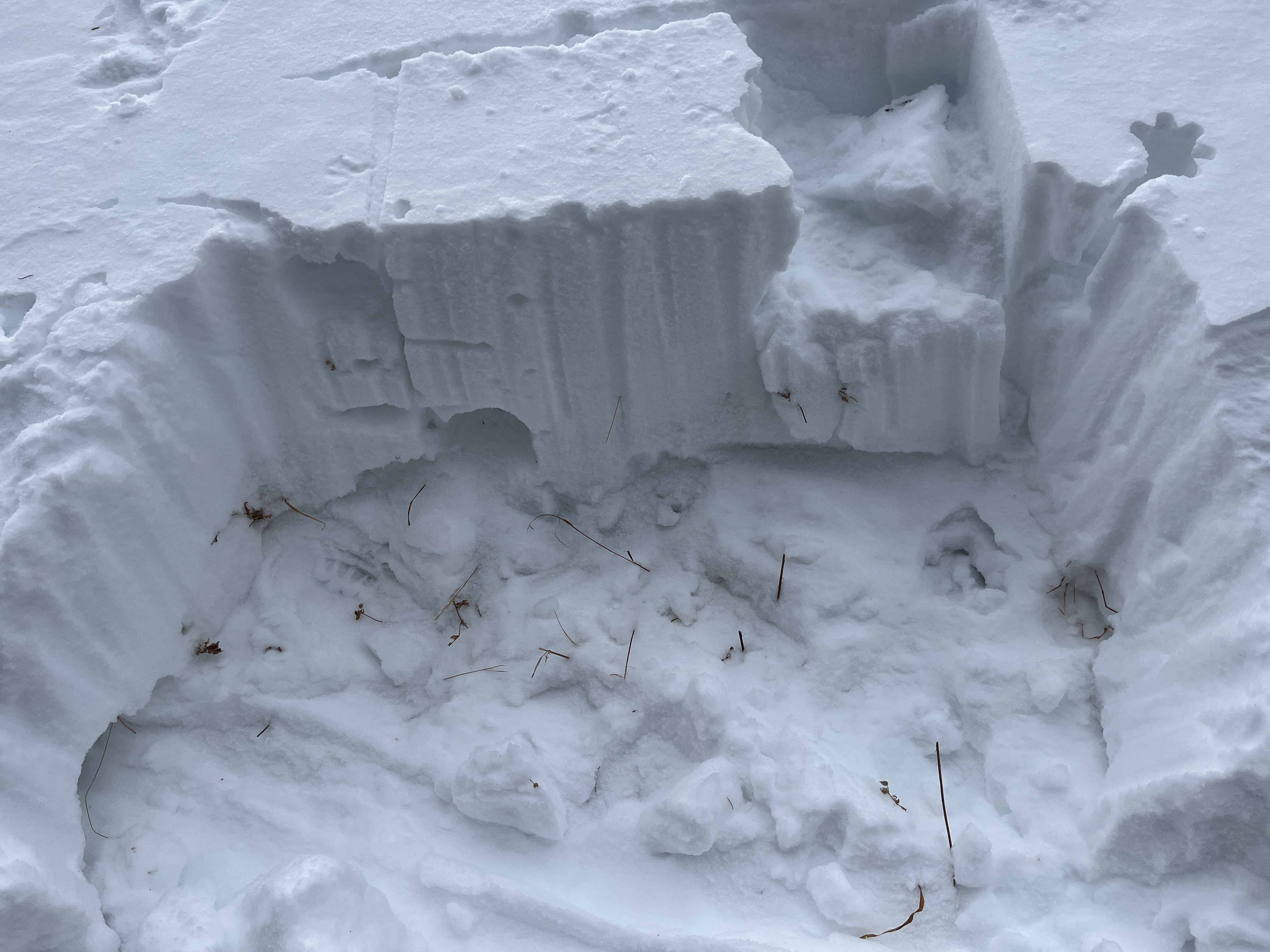
The weak sugary snow is only 1 to 2 feet deep, even in upper-elevation terrain. This is from 8800 feet on a north-facing slope in the Tony Grove Area.
General Announcements
-National Forest Winter Recreation Travel Maps show where it's open to ride: UWCNF Logan, Ogden LRD Tony Grove, Franklin Basin CTNF Montpelier
-Sign up for forecast region-specific text message alerts. You will receive messages about changing avalanche conditions, watches, and warnings...HERE.
-For all questions on forecasts, education, Know Before You Go, events, online purchases, or fundraising, call 801-365-5522.
-To report an avalanche or submit an observation from the backcountry, go HERE.
-Remember that the Tony Grove Road is not maintained for winter driving. Treacherous snow-covered and icy conditions will be encountered.

This forecast is from the U.S.D.A. Forest Service, which is solely responsible for its content. This forecast describes general avalanche conditions, and local variations always occur.