Check out our Holiday Auction

Forecast for the Logan Area Mountains

Toby Weed
Issued by Toby Weed on
Tuesday morning, December 14, 2021
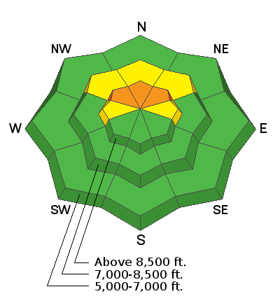
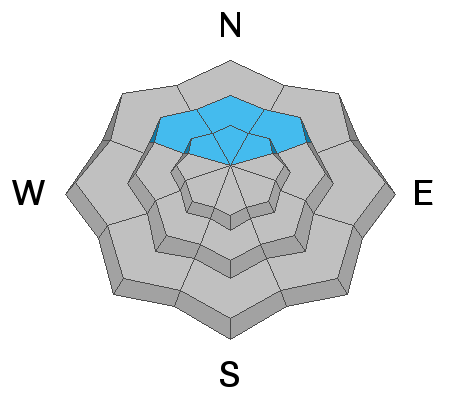
Strong winds created CONSIDERABLE avalanche danger in some areas. People are likely to trigger slab avalanches of wind drifted snow at upper elevations where strong south winds created hard drifts. Avalanches in north facing terrain may fail on a persistent weak layer and could be triggered remotely, from a distance, or below.
  • People should avoid travel on or under steep drifted slopes at upper elevations.
  • Southerly facing and lower elevation terrain was bare or very shallow before last week's storm, so avalanches are unlikely and the danger is LOW.
Low
Moderate
Considerable
High
Extreme
Learn how to read the forecast here
Special Announcements
Get free batteries for your transceiver and a chance to win 1 of 10 Black Diamond Rescue Kits, 1 of 3 Mammut Barryvox transceivers, or 1 of 3 BCA Tracker transceivers. Stop at a participating shop, fill out our survey and get a free set of batteries. Don't need batteries, but still want a chance to win? Simply fill out the survey to be registered. Promotion runs through December 19.
Weather and Snow
South winds increased another notch overnight and are ripping through the mountains and valleys this morning. The wind sensor at the CSI weather station on Logan Peak reports sustained winds in the 45 mph range, with gusts of nearly 80 mph. The winds built hard drifts and wind slabs downwind of powdery meadows or fetch areas. In some areas hard wind slabs formed on preexisting weak sugary snow, dangerous avalanche conditions exist, and people are likely trigger avalanches.
The National Weather Service issued a Winter Storm Warning for the Bear River Range and all Utah mountains through midday tomorrow, with 1 or 2 feet of snow and drifting from continuing strong winds. Along with much needed snow, this storm will bring a rapid increase in backcountry avalanche danger.
***Sunny slopes up high and most slopes below about 8000' were bare of snow before last week's storm and now are still mostly rocks and bushes. Some are bare again due to recent warm temperatures and strong winds, others are only covered by a few inches.
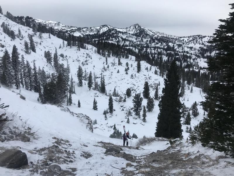
Belle making her way up to the wind-swept saddle. The strong south winds were funneled through the notch and scoured all the snow down to rocks.
Recent Avalanches
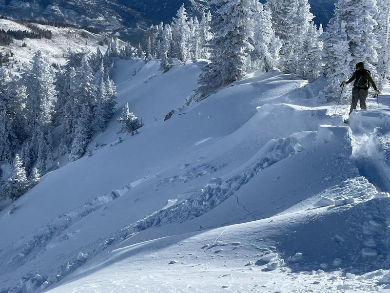
A skier reported triggering loud audible collapses and extensive cracking on the ridge near Steam Mill Peak Sunday.
Skiers triggered a small slab avalanche of drifted storm snow on Cornice Ridge Saturday. It was on a north facing slope at around 9300', about 20' wide and 15" deep.

Another party reported triggering a few audible collapses and remotely triggered from below a small slab avalanche that cracked and moved a bit but did not run.
Ad
Avalanche Problem #1
Wind Drifted Snow
Type
Location
Likelihood
Size
Description
The CSI Logan Peak wind sensor at 9700' shows increasing and very strong south winds overnight and this morning...
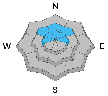
  • People are likely to trigger hard slab avalanches of wind drifted snow at upper elevations where the strong south winds are creating stiff drifts. Avalanches could be 1 to 2 feet-deep.
  • Hard wind slabs can be tricky. Waiting for a person to get out on them before releasing like a mouse trap.
  • Watch for and avoid stiff recently drifted snow in and around terrain features like gullies, sub-ridges, and cliff bands.
  • ​​​​​ Even small avalanches could be quite dangerous due to very shallow snow conditions.
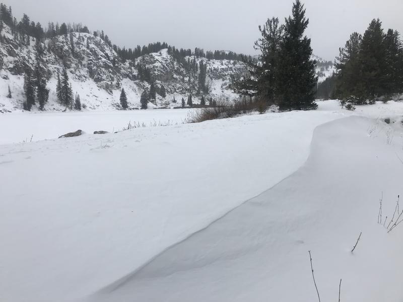
Strong south winds drifted last week's fresh snow into stiff drifts in exposed terrain.
Avalanche Problem #2
Persistent Weak Layer
Type
Location
Likelihood
Size
Description
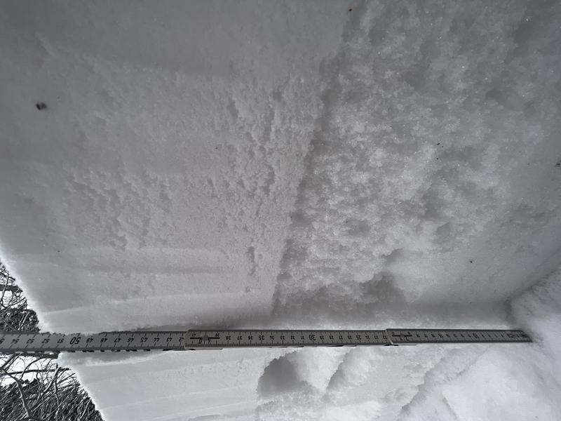
In some north facing terrain above about 8000', avalanches of wind drifted snow are likely to fail on a persistent weak layer consisting of sugary faceted grains.
  • Audible collapsing or "whumpfs" are a sign of unstable snow and of an active persistent weak layer problem.
  • Cracking in the snow surface is a sure sign of unstable snow.
  • Avalanches failing on this persistent weak layer could be triggered remotely, from a distance, or below.
Greg sent in this picture of his snowpit from near the top of Beaver Mountain on Friday (12-10-2021). Note the larger sugary faceted grains just below the nice fresh powder.
Additional Information
  • Always follow safe backcountry travel protocols. Go one person at a time in avalanche terrain, while the rest of your party watches from a safe area.
  • Check your avalanche rescue equipment, change your batteries, and practice often with your backcountry partners.
  • Be very careful, keep your speed down, and stay in control. Encounters with shallowly buried rocks or down trees in the early season have led to many season-ending injuries.
  • The Tony Grove Road is not maintained for wheeled vehicles in the winter season. Yesterday, some people drove 4-wheel-drive vehicles up to the lake, but conditions were apparently getting rather sketchy up high.
General Announcements
  • Check out all the upcoming education classes and clinics HERE.
  • Please submit your observations from the backcountry HERE.