Forecast for the Logan Area Mountains

Issued by Toby Weed on
Thursday morning, November 28, 2024
Thursday morning, November 28, 2024
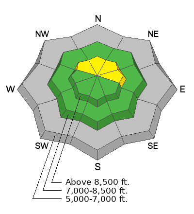
Heightened avalanche conditions exist in the backcountry, with widespread buried weak snow plaguing upper-elevation slopes facing northwest through east. The danger is MODERATE, and people could trigger small slab avalanches of wind-drifted snow, 1 to 2 feet thick, on slopes steeper than 30°. There is still insufficient snow for avalanches on most slopes at lower elevations.
Evaluate snow and terrain carefully, especially in drifted upper-elevation terrain.

Low
Moderate
Considerable
High
Extreme
Learn how to read the forecast here
 Special Announcements
SAVE THE DATES!
Tuesday, December 3 - 21st Annual Pray for Snow fundraiser/party, Cache, Logan Information and tickets available here.
Wednesday, December 4 - USU KBYG (Know Before You Go) Night, USU ARC
Saturday, December 7 - 17th Annual Utah Snow and Avalanche Workshop (USAW) - Information and tickets available here.
 Weather and Snow
Today, in the Logan Zone, people could trigger avalanches in the backcountry. Weak, sugary, or faceted snow from early November is widespread in upper-elevation terrain. Tuesday's snowfall probably overloaded some slopes with poor snow structure, causing elevated avalanche danger on upper-elevation slopes steeper than 30°. In exposed terrain, drifting built stiffer wind slabs on the underlying weak snow, and wind slab avalanches are possible. Although there may not be enough snow on many slopes to bury you, a ride over rocks in even a small avalanche could be quite dangerous.
- The 8500' Tony Grove Snotel reports 14°F and 22 inches of total snow on the ground. It's 13°F at the 8800' UAC Card Canyon weather station, with 24 inches of total snow.
- Currently at 9700' at the CSI Logan Peak weather station, it's 9°F and the wind is blowing from the west-northwest 25 mph, with gusts to 33 mph. The wind chill value is -11°F! At 9500' on UAC Paris Peak it's 9°F, and winds are from the west 16 to 20 mph.
- Today, expect mostly cloudy skies this morning, gradually becoming sunny. 8500' high temperatures will be around 20°F and winds will blow from the west around 3 to 6 mph.
Tonight, it will be partly cloudy, temperatures will drop to around 11°F, and winds from the west-southwest will blow 6 mph.Tomorrow, it will be sunny. Expect high temperatures around 22°F and winds will blow from the west 6 to 10 mph.
-
A high-pressure system will continue to build over the area, and we can expect stable atmospheric conditions, fair weather in the mountains, and haze in the valleys for at least the next week.
For more information, visit the UAC weather page here: Weather - Utah Avalanche Center
For Logan-specific weather go here: Logan Mountain Weather - Utah Avalanche Center
 Recent Avalanches
Observers this week reported triggering a few audible collapses or "whumpfs" in generally north-facing terrain above around 8000' in elevation. These triggered collapses indicate unstable snow.
No significant avalanches have yet been reported in the Logan Zone, but there were several in areas that picked up more snow and wind earlier in the week.
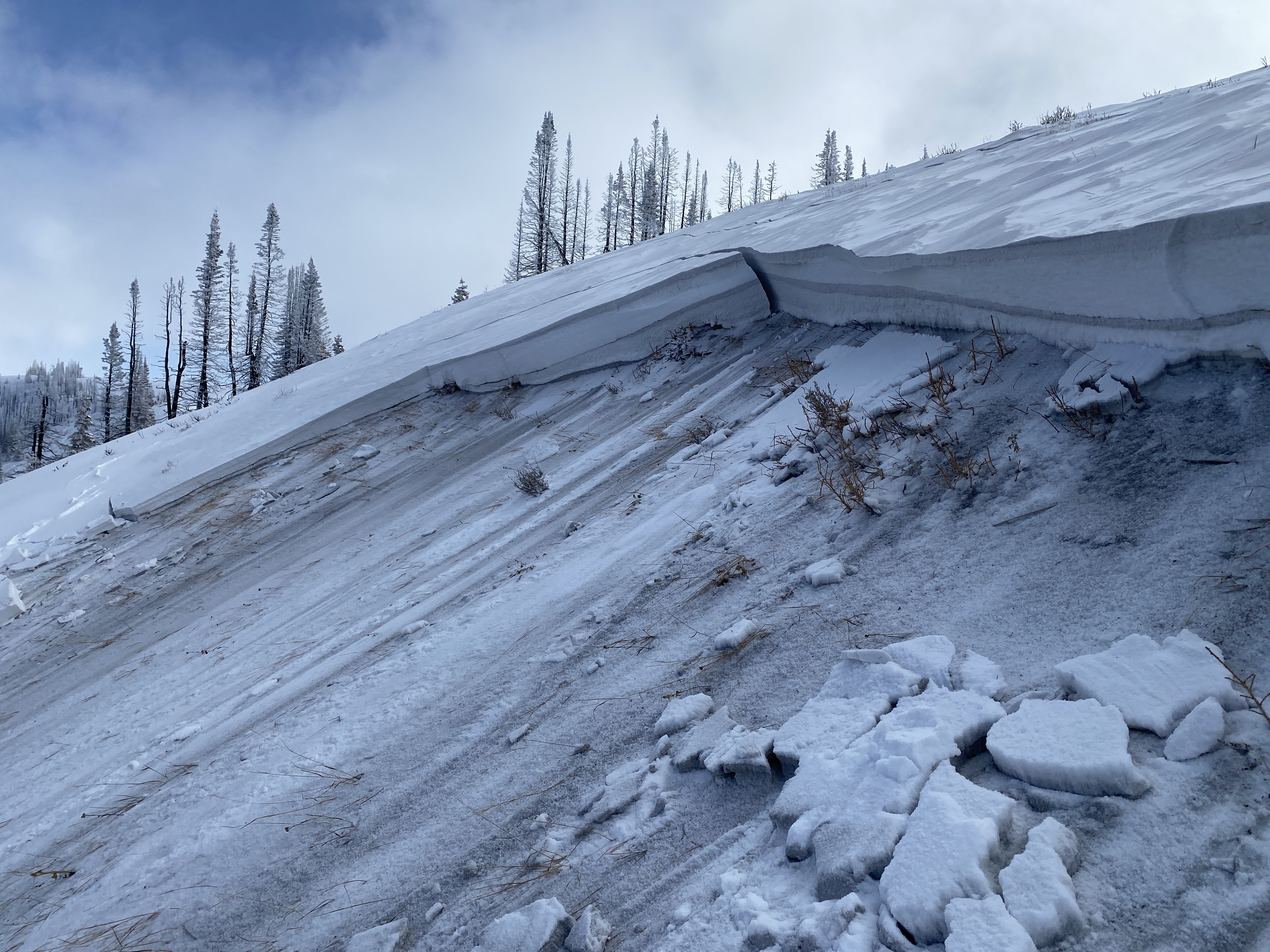
 This hard slab avalanche in the Uintas was remotely triggered by skiers near the ridge yesterday. Notice the wind deposited ash layer from the Yellow Lake Fire within the slab.
Avalanche Problem #1
Persistent Weak Layer
Type
Location

Likelihood
Size
Description
Heavy snowfall and drifting overloaded slopes plagued by very weak, sugary, or faceted snow, elevating the avalanche danger.
- Avalanches of wind-drifted snow are possible in drifted terrain where wind slabs have formed on slopes with poor snow structure. These could be 1 ' to 2' thick and perhaps 30 to 60 feet wide.
- Some soft slab avalanches of settled storm snow could step down into faceted snow near the ground.
- Cracking and collapsing or "whumpfs" are red flags indicating unstable snow.
- Avalanches might be triggered remotely or from a distance.
Additional Information
I revisited the November 25, 1989 Mark Miller Accident in the PowerPoint presentation above.

The video is from last year, but the message is still good for the early season. Take the time now to check your companion rescue equipment and refresh your skills with backcountry partners...
General Announcements
-National Forest Winter Recreation Travel Maps show where it's open to ride: UWCNF Logan, Ogden LRD Tony Grove, Franklin Basin CTNF Montpelier
-Sign up for forecast region-specific text message alerts. You will receive messages about changing avalanche conditions, watches, and warnings...HERE.
-For all questions on forecasts, education, Know Before You Go, events, online purchases, or fundraising, call 801-365-5522.
-Please continue to submit your observations from the backcountry so we can publish them and keep people informed of what you're seeing out there.
This forecast is from the U.S.D.A. Forest Service, which is solely responsible for its content. This forecast describes general avalanche conditions, and local variations always occur.


