Check out our Holiday Auction

Forecast for the Logan Area Mountains

Toby Weed
Issued by Toby Weed on
Saturday morning, January 30, 2021
HIGH avalanche danger exists on steep upper and mid elevation slopes in the Logan Zone. People are likely to trigger slab avalanches of wind drifted snow, as well as more dangerous avalanches involving old snow and failing on a widespread buried persistent weak layer. Natural avalanches are very possible. You can find safer conditions in sheltered and lower angled terrain, but avalanches are likely at all elevations today.
  • AVOID TRAVEL IN BACKCOUNTRY AVALANCHE TERRAIN TODAY
  • Stay off and out from under drifted slopes steeper than about 30 degrees.
Low
Moderate
Considerable
High
Extreme
Learn how to read the forecast here
Special Avalanche Bulletin
DANGEROUS AVALANCHE CONDITIONS EXIST AND CONDITIONS ARE PERFECT FOR AVALANCHE ACCIDENTS IN THE BACKCOUNTRY ACROSS THE MOUNTAINS OF NORTHERN UTAH THIS WEEKEND. AVALANCHES TRIGGERED BY PEOPLE COULD BE LARGE, VERY DANGEROUS, UNEXPECTED, AND PERHAPS DEADLY.
Weather and Snow
It's snowing nicely again this morning at Beaver Mountain. The 8400' Tony Grove Lake Snotel reports 9 inches of new snow in the last 24 hours and 48 inches of total snow. There is only 64% of normal Snow Water Equivalent for the date, and the overall snow pack is generally quite shallow across the Logan Zone. West winds are blowing around 25 mph this morning, with gusts in the 40 mph range at the 9700' CSI Logan Peak weather station. Dangerous avalanche conditions exist on drifted slopes at all elevations. We recommend people avoid travel in backcountry avalanche terrain and stay off and out from under slopes steeper than about 30 degrees.
Improving weather this weekend and enticing fresh powder may lure unsuspecting people into dangerous backcountry avalanche terrain. Snow showers will taper off this morning and it will cloudy in the mountains. Expect 8500' high temperatures around 22°F, west wind continuing today (currently blowing around 25 mph on Logan Peak), and wind chill values as low as -3°F. Tomorrow will be sunny, with mountain temperatures in the upper 20s.
Recent Avalanches
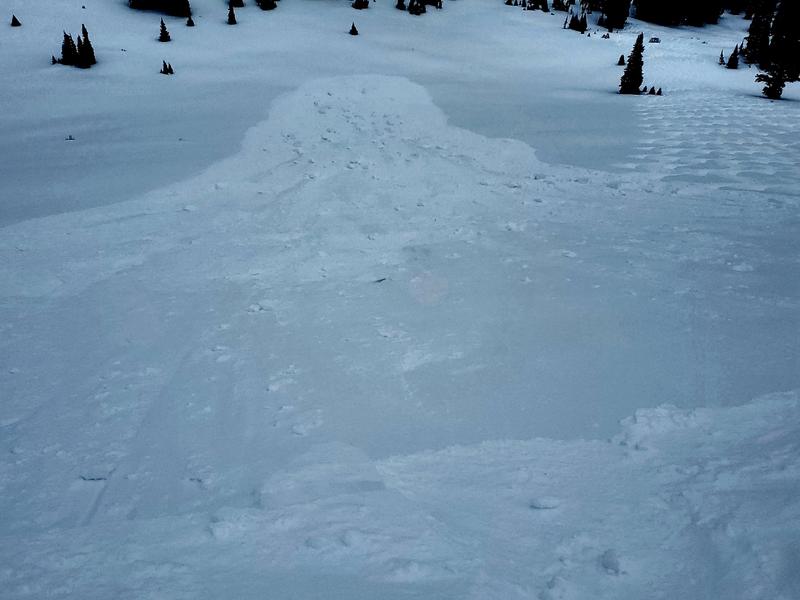
Yesterday a snowboard rider triggered a 1.5' to 3' deep and 100' wide avalanche of wind drifted snow on a relatively low angled, 30°east facing slope at around 9000' in the northern Bear River Range. No one was caught but the avalanche overran a few sets of tracks from previous runs.
This hard slab avalanche of freshly drifted snow was triggered yesterday on a fairly low angled slope as you can see in the picture.

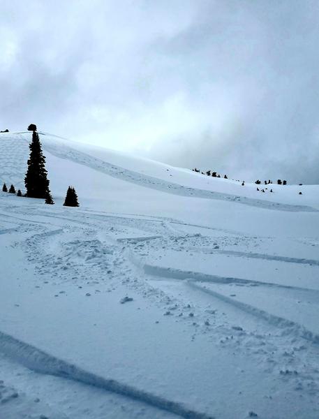
There were numerous natural avalanches of wind drifted snow at upper elevations across the zone in the past couple days. Of note are repeater avalanches in Three Terraces and the East Face of Providence Peak in upper Providence Canyon and a couple off Cornice Ridge, west of Tony Grove Lake. Visit our avalanche list HERE.
Ad
Avalanche Problem #1
Persistent Weak Layer
Type
Location
Likelihood
Size
Description
Very weak sugary or faceted snow near the ground is widespread across the region, and people could trigger avalanches where a slab of more cohesive snow has formed on top of the weak snow. A small avalanche overrunning a slope with poor snow structure could cause a larger, more dangerous avalanche. The load of the drifted new snow may be enough in some areas to overload deeper buried persistent weak layers that are widespread across the zone, and large and dangerous avalanches could result.
  • Avalanches failing on a buried persistent weak layer might be triggered remotely, from a distance, or worse from below!
  • Cracking and collapsing of the snow are a red flag, indicating unstable snow conditions.
These large faceted snow grains make up a nasty buried persistent weak layer that is widespread in the Logan Zone. It exists on slopes at all elevations across the zone and is especially prevalent in the Logan Peak Area.
Avalanche Problem #2
Wind Drifted Snow
Type
Location
Likelihood
Size
Description
Westerly winds today will continue to drift fresh snow into lee slope avalanche starting zones, and build drifts and wind slabs on steep slopes at all elevations. Drifting has created thick cohesive slabs, and people are likely to trigger slab avalanches of wind drifted snow in the backcountry again today. Dangerous avalanche conditions will persist through the weekend.
  • Watch for and avoid drifted snow near ridge tops and in and around terrain features like gullies, scoops, cliff bands, and sub ridges.
I observed this fresh natural avalanche of wind drifted snow on the east face of Providence Peak on Thursday.
Additional Information
Do you have the essential avalanche rescue gear (transceiver, probe, and shovel) and do you know how to use them? Watch this video to see how the three pieces of equipment work together. HERE
Please use the Beacon Training Park and Beacon Checker at the Franklin Basin Trailhead. It is free, fun, and easy to use.
General Announcements
Thanks to the generous support of our local resorts, Ski Utah, and Backcountry, discount lift tickets are now available. Support the UAC while you ski at the resorts this season. Tickets are available here.
Visit this website with information about Responsible Winter Recreation by the Utah Office of Outdoor Recreation.
EMAIL ADVISORY. If you would like to get the daily advisory by email you subscribe HERE.
Remember your information can save lives. If you see anything we should know about, please help us out by submitting snow and avalanche observations....HERE. You can also call us at 801-524-5304, email by clicking HERE, or include #utavy in your tweet or Instagram.
I will update this forecast by around 7:30 tomorrow morning.
This forecast is from the USDA Forest Service, which is solely responsible for its content. The forecast describes general avalanche conditions and local variations always occur.