Forecast for the Logan Area Mountains

Issued by Paige Pagnucco on
Sunday morning, January 26, 2025
Sunday morning, January 26, 2025
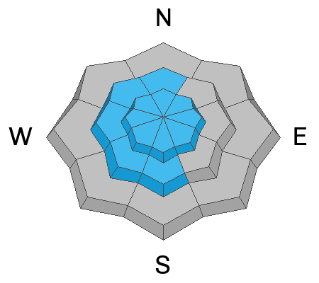
Avalanche danger is MODERATE on wind-loaded slopes steeper than 30° in upper elevation and westerly-facing mid-elevation terrain, where you could trigger a wind slab 1-2 feet deep. Watch for shooting cracks indicating instability, and avoid hollow-sounding or rounded pillows of snow. East winds are unusual, so look for and avoid wind slabs in unusual places. The danger is LOW in wind-protected areas.
Evaluate snow and terrain carefully, and reconsider your route if it takes you onto or under steep slopes with recent deposits of wind-drifted snow.

Low
Moderate
Considerable
High
Extreme
Learn how to read the forecast here


