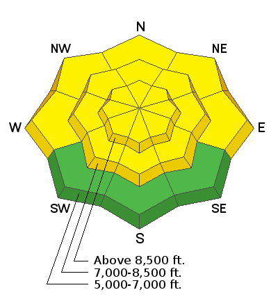
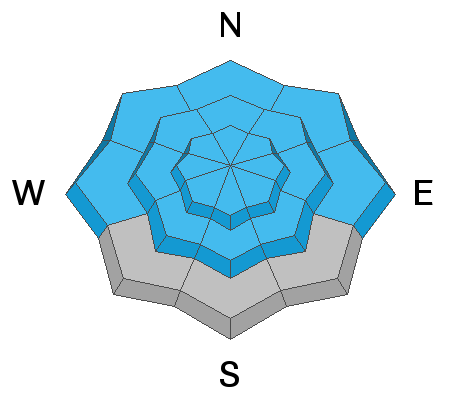
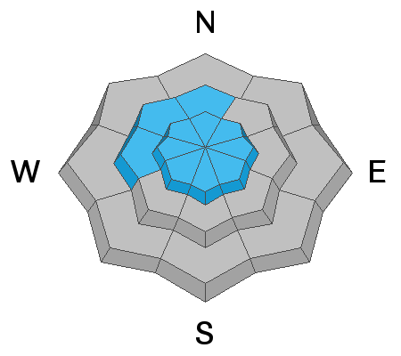
We've found nice shallow powder riding and skiing conditions at upper elevations in the Bear River Range in the past couple days. Several inches of new snow fell in the mountains across the zone Saturday and winds up until last night were fairly light, even at upper elevations. The new snow wasn't enough to change the avalanche danger much, people could trigger dangerous avalanches failing on a widespread buried persistent weak layer, and elevated avalanche conditions exist on steep slopes at all elevations.
The 8400' Tony Grove Lake Snotel reports only 60% of normal SWE for the date, and the existing snowpack is generally quite shallow in the Logan Zone. We went up on Red Pine Ridge yesterday and found that the snow is exceptionally shallow, weak, and perhaps unstable on steep slopes in the terrain around Logan Peak. The rocky approach up Providence Canyon and the shallow loose snow have kept traffic in the area pretty light and riders have been staying mostly in the flats and meadows. We recommend that people continue to avoid and stay out from under slopes steeper than about 30 degrees, and stay well clear of the obvious and historic avalanche paths in the area for a while.
Today will be cloudy, with a good chance for some snow showers this afternoon. Expect 8500' high temperatures around 18°F, a moderate southeast breeze veering from the southwest in the afternoon, and wind chill values as low as -12°F. More snow is likely this week in a progressive weather pattern, with intensifying south-southwest winds tomorrow and up to about 6 inches of accumulation possible in warm air advection Wednesday night and Thursday.
It was an active weekend and active again yesterday in the Wasatch Range, with numerous human triggered avalanches reported. Visit our avalanche list
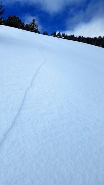
HEREObservers over the weekend reported a few natural and triggered shallow soft slab and loose avalanches of new snow in the Bear River Range, and yesterday we observed from a distance some natural activity involving new snow in the Adams Corral Area. There was one report of a small remotely triggered avalanche that involved old snow in the Peter Sinks area Sunday. It stepped down to into the faceted snow from December.


