Check out our Holiday Auction

Forecast for the Logan Area Mountains

Toby Weed
Issued by Toby Weed on
Monday morning, January 10, 2022
Heightened avalanche conditions and MODERATE danger exist on northerly facing upper and mid elevation slopes. Last week, drifting and tons of heavy snow overloaded slopes plagued by a deeply buried persistent weak layer, and in steep terrain above about 8000' in elevation, people might trigger dangerous avalanches breaking a few feet deep on sugary faceted snow near the ground. In some outlying terrain on steep, rocky, wind-blown slopes, where the snow is generally shallow, poor snow structure exists, weak layers are developing, and avalanches failing on a persistent weak layer are also possible.
  • Evaluate snow and terrain carefully, and make conservative decisions.

I will update this advisory before about 7:30 Wednesday morning.
Low
Moderate
Considerable
High
Extreme
Learn how to read the forecast here
Weather and Snow
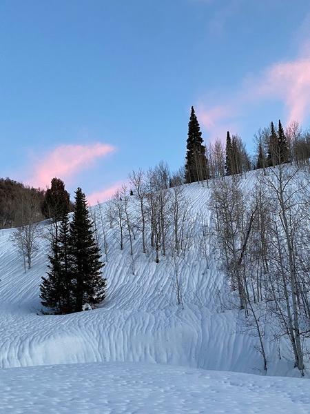
The snow is quite supportable, hard even, and you don't sink in more than a couple inches in most places. About three feet of very heavy snow with an incredible 8" of SWE (snow water equivalent) accumulated at upper elevations with last week's windy, wet, and warm storm. I found a supportable rain-crust all the way to the top of Beaver Mountain from last week's storm (1-6-2022), now capped by a couple inches of frosty powder.
The 8400' Tony Grove Snotel reports 27°F this morning and there is 80 inches of total snow containing 161% of average SWE for the date. Winds out of the south are gently blowing 15 to 20 mph this morning at the CSI Logan Peak weather station. Expect fair weather in the mountains today, continuing through late in the week. High temperatures at 8500' will be around 28°F today and will drop to around 10°F tonight. A southwest wind around 10 mph this morning will create wind chill values as low as -9°F.
Unfortunately, with dry air and cold clear nights a weak sugary layer will continue to develop on the snow surface, and sugary faceted snow near the ground will continue to grow and weaken where the snow cover is shallow.

It rained on the snow down low on Thursday, saturating the snowpack to the ground and creating runnels across the snow surface on all the slopes in mid Logan Canyon. The rough snow is now solidly refrozen...
Carly sent in this picture of intense rain channeling on a slope in lower Bunch Grass. All slopes in the area now look like this.
Recent Avalanches
Numerous natural loose wet avalanches, entraining big piles of heavy snow occurred in Logan Canyon Thursday afternoon.

From a distance yesterday, I thought I could see evidence of a fairly large natural avalanche off Cornice Ridge south of Naomi Peak. On Friday morning from Mendon I could see some natural activity involving wind drifted snow on the big east facing slopes of the Wellsville Range.
Heavy snow, wind drifting, and rain on snow caused many natural avalanches to occur during last week's storm across the zone.

Check HERE for all the latest observations and avalanche activity.
Ad
Avalanche Problem #1
Persistent Weak Layer
Type
Location
Likelihood
Size
Description
I'm still avoiding steep north facing slopes at upper elevations where a person might trigger a dangerous deep slab avalanche breaking on a persistent weak layer near the ground. Although they have become much less likely and harder to trigger, very dangerous deep hard slab avalanches remain possible on northerly facing slopes above about 8000' in elevation. These slopes have a layer of weak, sugary facets near the ground that could fracture and produce slab avalanches several feet deep and hundreds of feet across. The danger of deep slab avalanches failing on a persistent weak layer is diminishing as the snow pack continues to deepen and gain weight, and the sugary faceted snow is compressed into the ground features. However in some isolated areas, ( especially in areas where the snowpack is shallower), avalanches might be triggered remotely, from a distance, or from flatter terrain under steep slopes.
Yesterday, I found weak faceted snow at the bottom of the snowpack on a shallow (previously scoured) west facing slope in the Beaver Mountain Backcountry.
Additional Information
  • Always follow safe backcountry travel protocols. Go one person at a time in avalanche terrain, while the rest of your party watches from a safe area.
  • Check your avalanche rescue equipment, change your batteries, and practice often with your backcountry partners.
    Check slope angles and stay off of and out from under slopes steeper than 30° and adjacent slopes.
General Announcements
Who's up for some free avalanche training? Get a refresher, become better prepared for an upcoming avalanche class, or just boost your skills. Go to https://learn.kbyg.org/ and scroll down to Step 2 for a series of interactive online avalanche courses produced by the UAC.
  • Check out all the upcoming education classes and clinics HERE.
  • Please submit your observations from the backcountry HERE.
This information does not apply to developed ski areas or highways where avalanche control is normally done. This forecast is from the U.S.D.A. Forest Service, which is solely responsible for its content. This forecast describes general avalanche conditions and local variations always occur.