Forecast for the Abajos Area Mountains

Issued by Eric Trenbeath on
Tuesday morning, March 31, 2020
Tuesday morning, March 31, 2020
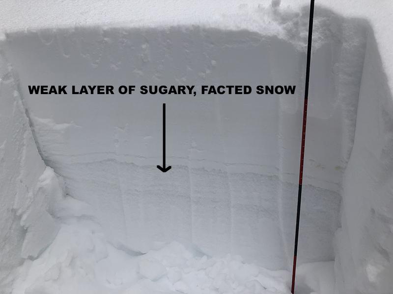
Recent snow and southerly winds have formed fresh drifts on upper elevation, northerly aspects and the avalanche danger is MODERATE on steep, wind drifted slopes. Wind drifts are recognizable by their smooth rounded appearance, and cracking is a sign of instability. On these same slopes an isolated possibility exists for an avalanche to fail on a buried persistent weak layer of loose, sugary, faceted snow. And finally, with a strong sun and warm temperatures, the danger will rise for loose, wet avalanches on sun-exposed slopes. Look for signs of instability such as pinwheels and point release sluffs, and get off of and out from under steep slopes that become wet and sloppy.

Low
Moderate
Considerable
High
Extreme
Learn how to read the forecast here