Forecast for the Abajos Area Mountains

Eric Trenbeath
Issued by Eric Trenbeath on
Monday morning, March 23, 2020
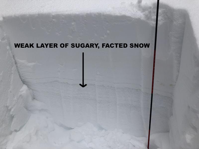
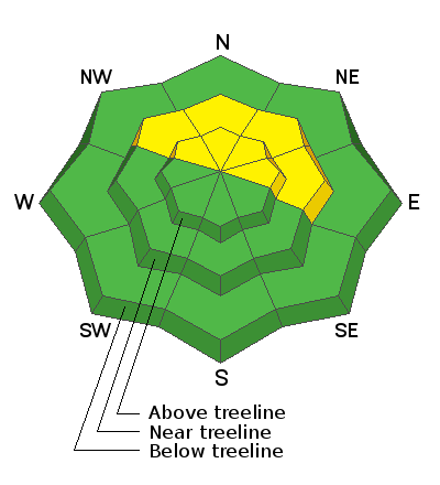
The avalanche danger is MODERATE on steep, upper elevation slopes that face NW-N-E where human triggered avalanches involving wind drifted snow are possible. On isolated slopes in these same areas, human triggered avalanches failing on a buried persistent weak layer of loose, sugary, faceted snow are also possible. Most other terrain has generally LOW danger.
Low
Moderate
Considerable
High
Extreme
Learn how to read the forecast here
Special Announcements
UAC operating schedule - We will continue issuing regular avalanche forecasts into mid April.
Spring Awareness Campaign - The UAC counts on donations from the backcountry community. We know these are uncertain times and any donation during our awareness campaign will help us continue providing avalanche forecasting and education.
CDC Guidelines - Even in the backcountry and in parking lots, please follow CDC guidelines like limiting group size and keeping a distance of at least 6 feet from other people to protect yourself and others. Read the guidelines HERE.
Taking risks - Be extra conservative to avoid the risk of accidents which can stress the capacity of our medical system.
New to the backcountry (including riding at closed resorts) - Watch the award-winning, 15 minute Know Before You Go video, or take the 5-part, free online-learning series.
Weather and Snow
Southerly winds ramped up last night and clouds have begun to spill in as a weak weather system approaches our area. Look for scattered snow showers to develop after about 10:00 a.m. with 1"-2" possible. SW winds will blow in the 15-20 mph range with ridgetop gusts near 30. High temps at 10,000' will be right around freezing. Tue and Wed look to be dry and mostly sunny with the next system slated to affect the region on Thursday. It doesn't look real promising for us at this time.
Conditions are vastly improved with 10"-16" of new snow falling since Wednesday. The sun came out yesterday and exposed slopes will be crusty today. Southerly winds have blown and drifted snow on to upper elevation northerly facing slopes and unstable wind slabs in these areas are your primary concern today. Underneath, a layer of weak, sugary, faceted snow exists that may be problematic after the most recent snow load. In isolated areas, a triggered wind drift could step down to this buried weak layer causing a deeper and more dangerous avalanche.
Kevin Dressel photo.
Snow totals at Buckboard Flat (8924')
Snow totals at Camp Jackson (8858')
Recent Avalanches
I received this report of a natural avalanche on Horsehead Mountain that occurred on Thursday. It was reported as 100' wide on a steep, NE aspect around 11,000'. Kevin Dressel detailed it more in this report, with photos, from his observations on Friday. I suspect this slide was storm slab avalanche involving the most recent snow, but it's possible that it may have stepped down into looser, weak, faceted snow that has been developing over the past several weeks.
General Announcements
This forecast is from the U.S. Forest Service, which is solely responsible for its content. This forecast describes general avalanche conditions and local variations always occur.