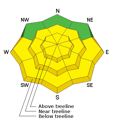
Forecast for the Abajos Area Mountains

Issued by Eric Trenbeath on
Friday morning, March 19, 2021
Friday morning, March 19, 2021
The avalanche danger is MODERATE on steep, wind-drifted slopes at mid and upper elevations on slopes facing NW-N-E-SE. Avoid steep slopes where you can detect recent deposits of wind drifted snow. In these same areas, last weekend's snow may have added enough of a load for avalanches to fail down to a buried persistent weak layer causing a deeper and more dangerous avalanche.
As things heat up today anticipate a MODERATE danger for loose, wet avalanches on sun-exposed slopes. Signs of instability include rollerballs, pinwheels and sloppy wet snow up around your boot tops. Get off of and out from under steep slopes when these signs are present.

Low
Moderate
Considerable
High
Extreme
Learn how to read the forecast here


