
Forecast for the Abajos Area Mountains

Issued by Eric Trenbeath on
Tuesday morning, March 17, 2020
Tuesday morning, March 17, 2020
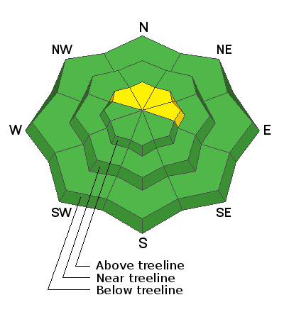
Blowing and drifting snow have created isolated wind slabs on upper elevation slopes facing NW-N-E. In these areas, there is a MODERATE danger for human triggered avalanches involving recent deposits of wind drifted snow. Most other terrain has LOW danger. With warming temps today we may see some loose wet activity on steep, sun-exposed slopes. Be alert to signs of instability such as roller balls and pinwheels, and stay off of steep slopes that become wet and sloppy.
Low
Moderate
Considerable
High
Extreme
Learn how to read the forecast here


