Forecast for the Abajos Area Mountains

Eric Trenbeath
Issued by Eric Trenbeath on
Sunday morning, March 14, 2021
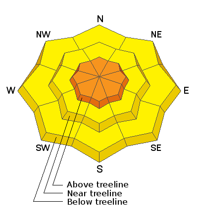
New snow combined with wind has created dangerous avalanche conditions and the avalanche danger is CONSIDERABLE at upper elevations and steep, wind drifted slopes should be avoided today. On slopes facing the north half of the compass, the additional snow load may be enough to trigger avalanches down to a buried persistent weak layer causing a deeper and more dangerous avalanche. At mid and lower elevations the danger is MODERATE. Suspect avalanches on steep slopes that have more than about 8" of new snow.
Low
Moderate
Considerable
High
Extreme
Learn how to read the forecast here
Special Announcements
Weather and Snow
5"-10" of snow has fallen across the range with the south side near Camp Jackson being favored. We should see continued snowfall today with another 4"-8" possible. Winds were mostly calm yesterday but are on the increase today from the NW and will reach speeds of 20-25 mph with gusts near 40. High temps will be in the mid 20's. Tomorrow will be dry and partly sunny before the next system moves in on Tue.
Snow totals at Buckboard Flat (8924')
Snow totals at Camp Jackson (8858')
Additional Information
Information on outdoor recreation - The State of Utah created this webpage with information about recreating on both state and federal public lands during the current health crisis.

New to the backcountry (including riding at closed resorts) - Watch the award-winning, 15 minute Know Before You Go video, or take the 5-part, free online-learning series.
General Announcements
This forecast is from the U.S. Forest Service, which is solely responsible for its content. This forecast describes general avalanche conditions and local variations always occur.