Forecast for the Abajos Area Mountains

Eric Trenbeath
Issued by Eric Trenbeath on
Thursday morning, March 12, 2020
The avalanche danger is generally LOW this morning but could rise to MODERATE with daytime heating. Be alert to signs of wet instability and stay off of steep slopes as they become punchy, wet, and sloppy.
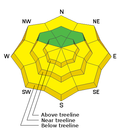
Low
Moderate
Considerable
High
Extreme
Learn how to read the forecast here
Special Announcements
Weather and Snow
Weather: No new snow fell in the mountains yesterday. Today look for mostly sunny skies, light WNW winds, and very warm temps in the low 40's. We should see increasing clouds later today as the much anticipated low off the Southern California coast moves inland. This moist system has the potential to give us a good shot of snow tomorrow but there are still a few discrepancies in the models. Keep your fingers crossed!
Snowpack: Spring-like conditions are in effect with melt-freeze crusts on sun exposed slopes that become wet and punchy during the day. Northerly facing, wind exposed terrain is scoured and crusted, while some soft, powdery snow can still be found on sheltered aspects.
Snow totals at Buckboard Flat (8924')
Snow totals at Camp Jackson (8858')
General Announcements
This forecast is from the U.S. Forest Service, which is solely responsible for its content. This forecast describes general avalanche conditions and local variations always occur.