Forecast for the Abajos Area Mountains

Issued by Eric Trenbeath on
Friday morning, February 15, 2019
Friday morning, February 15, 2019
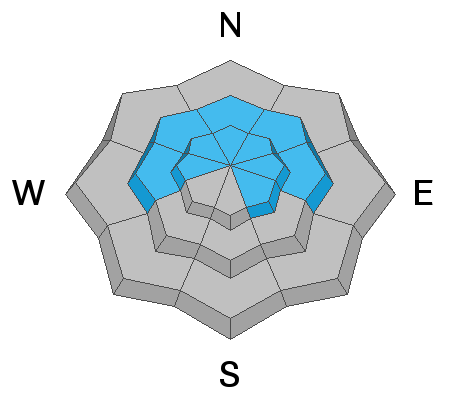
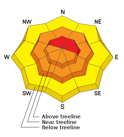
Heavy snowfall accompanied by strong winds have created dangerous conditions. The avalanche danger is HIGH on steep upper elevation terrain that faces NW-N-E, and human triggered avalanches involving new and wind drifted snow are certain are certain in these areas. On most other mid and upper elevation terrain the danger is CONSIDERABLE and human triggered avalanches are likely. The new snow load has also increased the danger for triggering a deep and dangerous avalanche failing on a buried, persistent weak layer. This problem is greatest on steep slopes facing NW-N-E. Most low elevation terrain has a MODERATE danger. Backcountry travelers today need to have excellent route finding and snow stability analysis skills. Stay off of, and out from under steep, avalanche prone terrain.
Low
Moderate
Considerable
High
Extreme
Learn how to read the forecast here