Forecast for the Abajos Area Mountains

Issued by Eric Trenbeath on
Thursday morning, February 14, 2019
Thursday morning, February 14, 2019
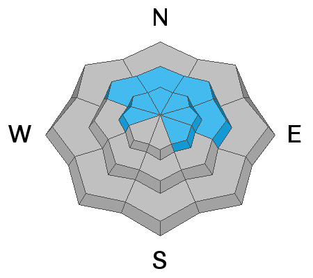
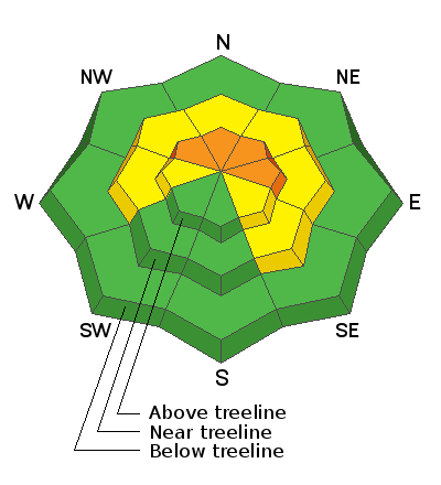
The avalanche danger is generally MODERATE this morning but will likely rise to CONSIDERABLE this afternoon when human triggered avalanches involving wind drifted snow will become likely. The danger will be greatest on steep, upper elevation, wind drifted slopes that face NW-N-SE and human triggered avalanches involving buried, persistent weak layers, are also possible in these areas. Avoid steep slopes with recent deposits of wind drifted snow. With an active weather pattern in store, expect the danger to increase over the next several days!
Low
Moderate
Considerable
High
Extreme
Learn how to read the forecast here