Forecast for the Abajos Area Mountains

Issued by Eric Trenbeath on
Thursday morning, November 28, 2019
Thursday morning, November 28, 2019
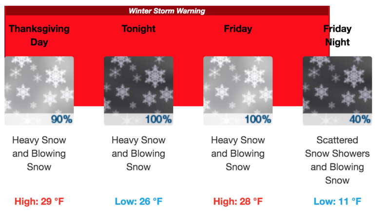
A powerful winter storm is underway and the avalanche danger will rise quickly today. 2' - 3' of snow is expected by the end of the day tomorrow. The avalanche danger will rise to CONSIDERABLE today and human triggered avalanches involving new and wind drifted snow are likely. The danger will continue to increase and become more widespread as new and wind drifted snow piles up. By tomorrow the avalanche danger could reach HIGH. Backcountry travelers need to have good route finding skills and know how to avoid being on or underneath avalanche terrain. Avoid steep wind drifted slopes and stay out from under run out zones.

Low
Moderate
Considerable
High
Extreme
Learn how to read the forecast here