Forecast for the Abajos Area Mountains

Issued by Eric Trenbeath on
Tuesday morning, November 26, 2019
Tuesday morning, November 26, 2019
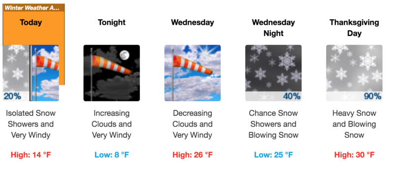
Last night's storm brought another 8-10" of snow to the Abajo Mountains and coverage is still quite thin. Lower elevation snow from last week had melted off, and the most recent snow fell on bare ground at Camp Jackson and at Buckboard Flat. At North Creek Pass I expect a base of around 18". As of yet there isn't enough snow for winter recreation, or to pose much of a threat of avalanches. You may encounter an isolated, sensitive wind drift on an exposed, upper elevation slope. With a powerful storm setting up to affect the region on Thanksgiving, I anticipate issuing danger ratings by this weekend.

Low
Moderate
Considerable
High
Extreme
Learn how to read the forecast here