Do you have the essential avalanche rescue gear (transceiver, probe, and shovel) and do you know how to use them?
Watch this video to see how the three pieces of equipment work together.
Camp Jackson and Buckboard Snotel sites are both reporting 3" of new snow this morning so expect to find a couple more up high. Southerly winds that have been cranking for the last three days finally backed off around 9:00 p.m. before they began shifting around to the WNW. We should see clearing skies today becoming mostly sunny. NW winds will be mostly light and high temps will be in the low 20's. High pressure builds over the next few days with the next storm system being advertised for mid-week.
Snowpack Discussion
A significant load of snow combined with wind has created dangerous avalanche conditions in the Abajo Mountains. The underlying snowpack is very weak and is comprised of loose, sugary faceted snow. Dense drifts and slabs now overly this poor snowpack structure and conditions are unstable. In our travels yesterday in the La Sals, the impacts of Wednesday's wind event were evident and can be expected to be found in the Abajos as well. In areas below treeline, last weekend's storm snow is less wind-affected. Near treeline, depth is variable and much of the snow has been stiffened by the wind. In these areas, the snow is more supportive and we experienced less cracking and collapsing than we had expected. In areas that have wind-drifted snow, the snowpack is considerably deeper with a moderately dense slab (4F to 1F hardness) overlying weak basal facets (F hardness) above the October and November crusts. Above treeline, large wind drifts and significant cross loading were easily observed on leeward aspects, ranging from west to north to east. Poor snowpack structure still plagues our mountains, with numerous persistent weak layers buried both underneath recent snow, as well as near the bottom of the snowpack. Strong winds have built stiff slabs on these weak layers and may be triggered by the weight of a skier or rider, especially in places where the slab is thin and weak.
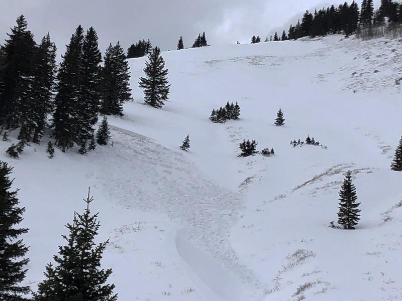
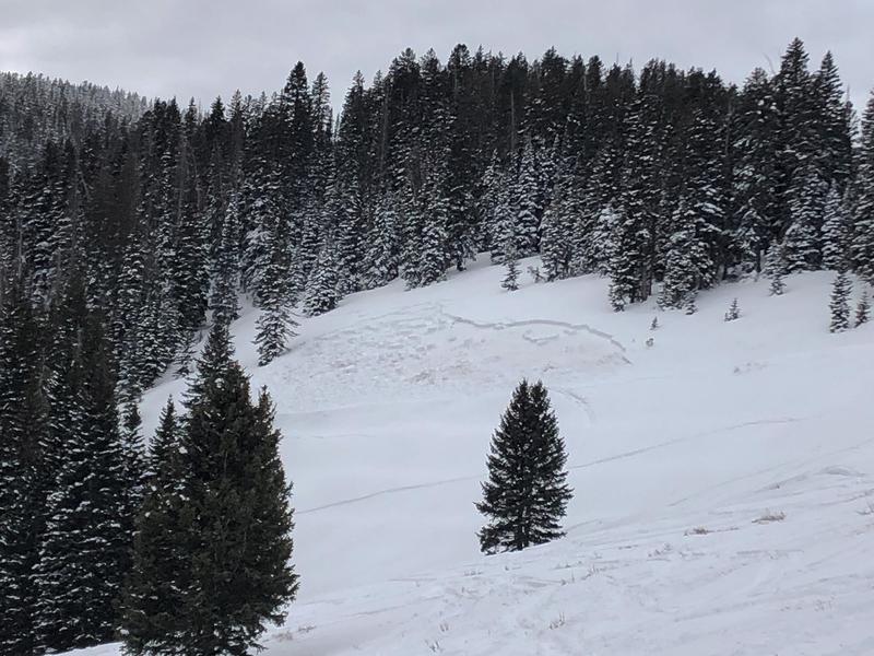
In my travels yesterday I observed a couple of slab avalanches that failed on weak, sugary snow near the ground on steep, NE aspects. Recent avalanches are clear signs of instability. Check back for more details on these slides.
Mathew Cozart reported observing several avalanches yesterday. Read his report
here.