Observation Date
4/19/2025
Observer Name
Kelly
Region
Salt Lake » Little Cottonwood Canyon
Location Name or Route
White Pine-Chipman-Thunder Peak-Bells
Comments
Failure on a density change 2"-3" off the melt freeze crust and 1"-2" from the surface. The surface failure was a bigger concern on steeper (greater than 35°) slopes, but with slough management was not an issue where I traveled. The density change within the rimed precipitation particles was what Chad talked about yesterday in his Red Baldy observation and it appeared to have stabilized more than what he found yesterday.
Even though we have stopped danger ratings for the year, we are continuing to update the avalanches and observations pages. This is a great place to get updated information from other backcountry users in the community. The Utah Avalanche Center really is a community based organization and I use the avalanches and observations page all winter long as part of my forecasting duties. Thank you to all the users that take time to submit.
There were signs of new snow avalanche debris on north facing slopes that most likely occurred at the start of the storm as it had a layer of new snow over the top. Stability was very good and there were tracks on steep slopes in all the drainages where I traveled.
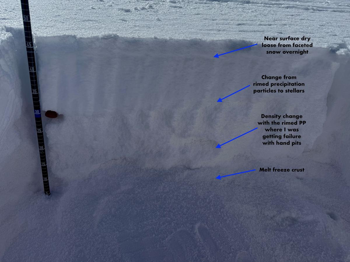
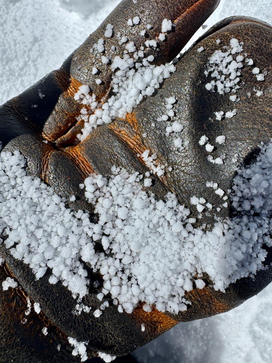
Photo of wet loose avalanches on a northeast aspect in Bell's Canyon at 8,800'
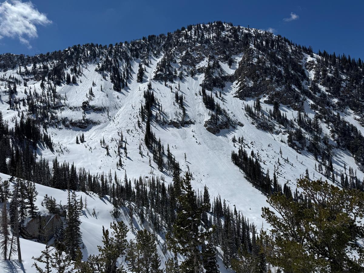
Photo of rimed preciptation particles above the melt-freeze crust
Photo of wet loose avalanches on a northeast aspect in Bell's Canyon at 8,800'
I was inspired by Drew's mention of Dave Hanscom's birthday in his forecast the other day. I really like long tours in the springtime when the avalanche danger has dropped, the days are longer and coverage is generally pretty good. Today, was world class in that the temperatures stayed low all day long which kept the wet snow at bay in the higher elevation terrain. Hanscom and Kelner's Wasatch Tours books are great for trip planning, but also for more of the history of skiing and backcountry travel in the Wasatch. If you're piecing new terrain together in the Wasatch, take a look and see what the generation's before us did.
Today's Observed Danger Rating
None
Tomorrows Estimated Danger Rating
None
Coordinates


