
Observation Date
4/12/2025
Observer Name
Kelly
Region
Salt Lake » Cottonwood Canyons
Location Name or Route
Silver Fork/Upper LCC
Comments
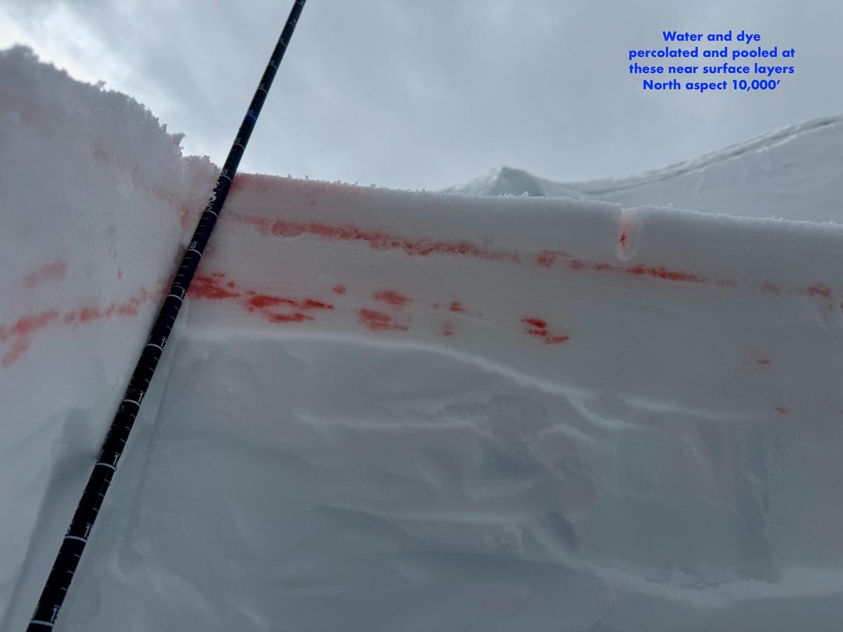
Today, I went out with red dye to see if I could find any areas where the melt water was percolating and pooling deeper in the snowpack. On this north facing slope I found water pooling just below the snow surface with one percolation column running below the dirt layer (vertical column below). Looking for water pooling and percolation columns can be a good way to see how deep the melt-water, or in some mountain regions, rain has moved through the snowpack. In some cases water hitting facets or buried PWL's can trigger large wet slab avalanches. Read more about wet slabs HERE.
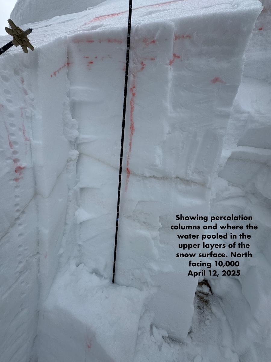
The dye in this photo had been allowed to percolate about an hour in the below photo.
I also dug on a south facing slope and did the dye test to see how much deeper the melt-water was percolating and where it was pooling. What I found on south facing slopes in upper LCC were a more shallow snowpack just under 3' (1meter) that was more saturated than the north facing slope above at the same elevation. The south facing slope had more dispersed water moving through the snowpack and most of the red dye pooled above a melt-freeze crust 2' (60cm) from the ground, with a bit of dye making it to the dirt layer 18" (45cm) from the ground after 45mins of saturation time. The trick with the south facing slopes in the Wasatch is that the snowpack often melts before the water percolates deep enough to get large wet slab avalanches on this slope. Like most things avalanche related there are exceptions and the right weather events can lead to large wet slabs on south facing slopes, but that is an avlanche class all by itself. Read more about wet slab avalanches in more northern climates HERE.
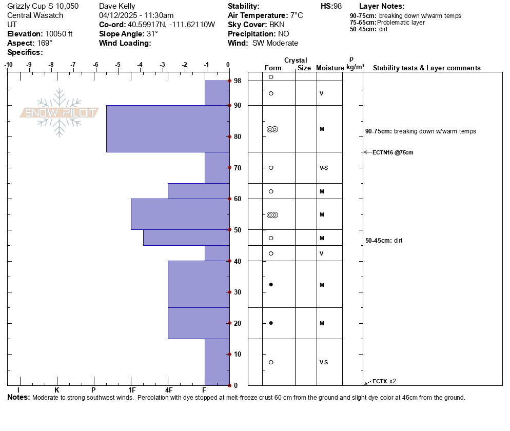
In the photo below you can see just how much water (dye) pooled above the melt-freeze crust 2' (60cm) from the ground. This layer would be a likely place to see wet slab avalanches in the right conditions.
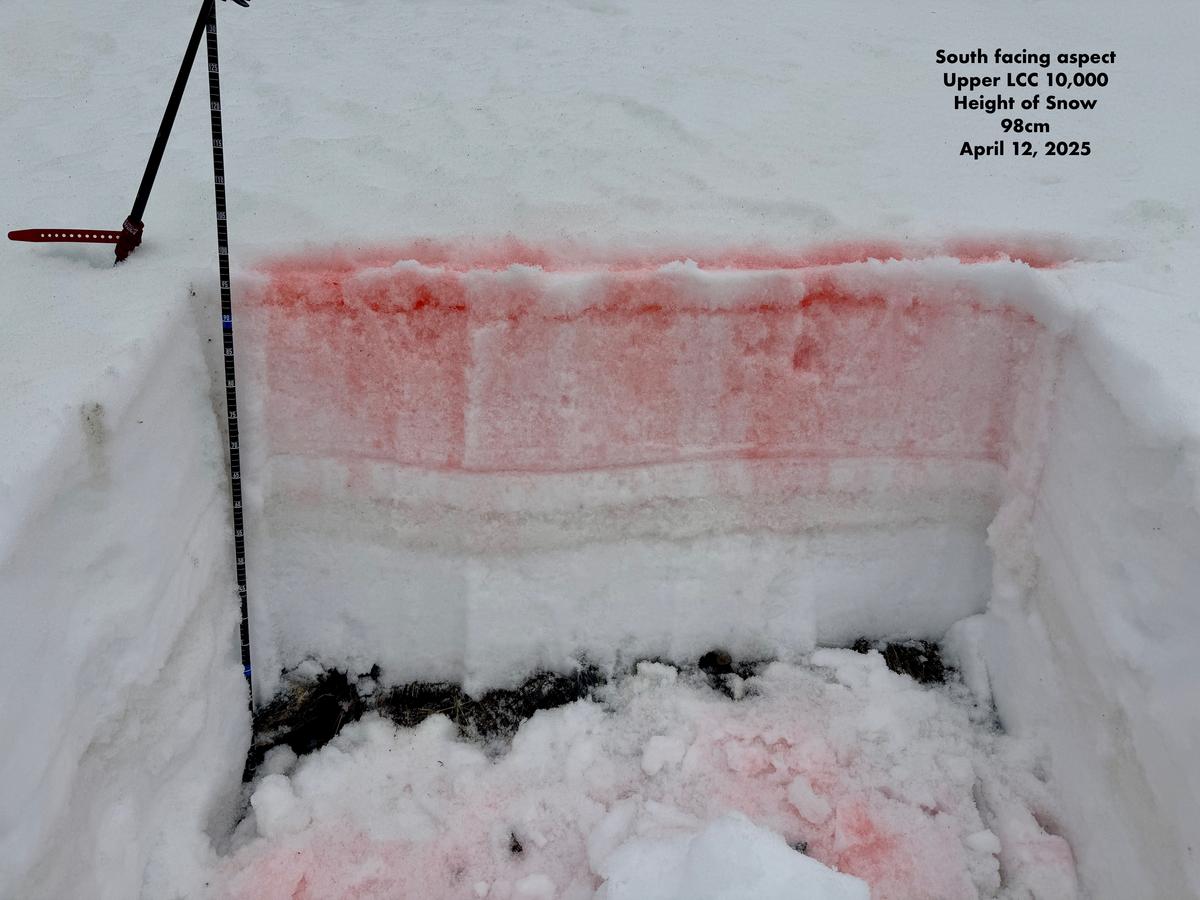
Photo showing a cut out with the most water (dye) at 2' (60cm) from the ground and some water pooling in the dirt layer 18" (45cm). The dye in this case had been allowed to percolate about 45 minutes at the time of this photo.

I went out early and was out of the mountains just after noon. With such a light surface freeze overnight I knew the window would be limited for supportable travel. I went out with the intention to see how water was pooling on north and south facing slopes. I went looking for a thinner north facing slope where we had repeater avalanches from earlier this season to see how deep the snowpack was and if there was any water getting close to the facets near the ground. What I found was that there wasn't water percolating anywhere near the rounding facets near the ground. This could change if you found a thinner snowpack, steeper terrain that had a bit of east or west aspect, or a hanging snowfield. Where and when I traveled today, I found overall LOW avalanche danger. By early afternoon, I would imagine the danger rose to MODERATE on most slopes.
Today's Observed Danger Rating
Low
Tomorrows Estimated Danger Rating
None
Coordinates


