Observation: Pole Line Pass

Observation Date
2/17/2025
Observer Name
Champion & Meisenheimer & Pagnucco
Region
Provo » Snake Creek » Pole Line Pass
Location Name or Route
Pole Line Pass
Weather
Sky
Broken
Precipitation
Light Snowfall
Wind Direction
West
Wind Speed
Light
Weather Comments
A mixed bag of weather today. Skies were broken throughout most of the day, with generally light snowfall. Periods of sunshine broke through the cloud cover. Around 2 PM, there was one period of moderate to heavy snowfall. Winds were primarily light where we traveled, with a few moderate gusts along ridgelines and obvious signs of wind drifting.
Snow Characteristics
New Snow Depth
12"
New Snow Density
Low
Snow Surface Conditions
Powder
Snow Characteristics Comments
Riding conditions are great basically everywhere. There's 1–2 feet of new low-density snow across the range. Snow depths varied; near Pole Line Pass, they seemed to decrease. Along ridgetops, there were noticeable cornices and drifted firm snow.
Red Flags
Red Flags
Recent Avalanches
Heavy Snowfall
Wind Loading
Poor Snowpack Structure
Red Flags Comments
A lot of red flags across the range. It was nice to get some clear skies at times for better visuals. Noticed multiple old avalanches, primarily on E/SE-facing aspects, that seemed to be remotely triggered on the crust-facet interface. Lots of recent snowfall and an overall poor snowpack structure. Below 8,500', the snowpack is shallow, with primarily facets at the ground. Above 8,500', the mid-pack crust/graupel interface is more noticeable than in most places I’ve traveled in the central Wasatch. On E/SE aspects, we found the thin crust interface, similar to what I found on Reynolds.
Avalanche Problem #1
Problem
Persistent Weak Layer
Problem #1 Comments
The snowpack structure remains the primary issue in Provo, with plenty of weak snow depending on the aspect. The new snow seems to be gaining stability, but multiple weak layers exist—either at the ground, mid-pack sandwiched with facets, or about 10 inches down surrounding a thin crust.
Below 8,000', we found a snowpack with obvious facets near the ground but were unable to get any results on that layer, though the structure was clear. Near 9,000' on a west-northwest aspect, we found both weak snow at the ground and a crust-facet-graupel interface about 90 cm from the ground. While we didn’t get any results in our pit, we could easily pry the block off.
The key suspect in most of the recent avalanches we saw while traveling seemed to be well-connected aspects with a slight east/southeast tilt.
8900' - W/NW Aspect - Pit wall with the obvious crust graupel interface mid-pack
Hand hardness - 8900' - W/NW
Comments
Some avalanches were observed throughout the field day - likely triggered within the last 72 hours.
Recent avalanche that ran across the road - E/SE tilt - likely failed on thin crust interface
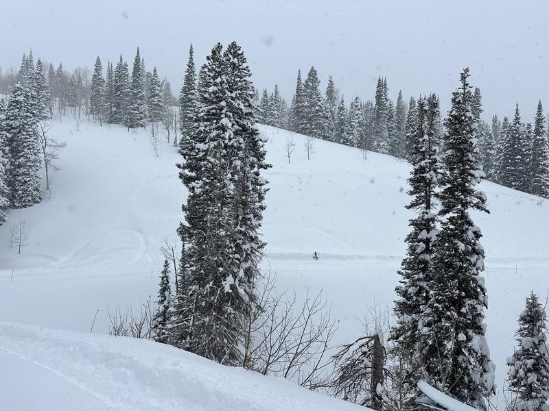
Generally south facing terrain - trigger/weak layer unknown
Today's Observed Danger Rating
Considerable
Tomorrows Estimated Danger Rating
Considerable
Coordinates