Observation Date
1/17/2025
Observer Name
Kelly, Grainger, Gagne, Tucker, Webber
Region
Salt Lake » Big Cottonwood Canyon » Pioneer Ridge
Location Name or Route
Pioneer Ridge-Skiers right side of Martha Bowl
Comments
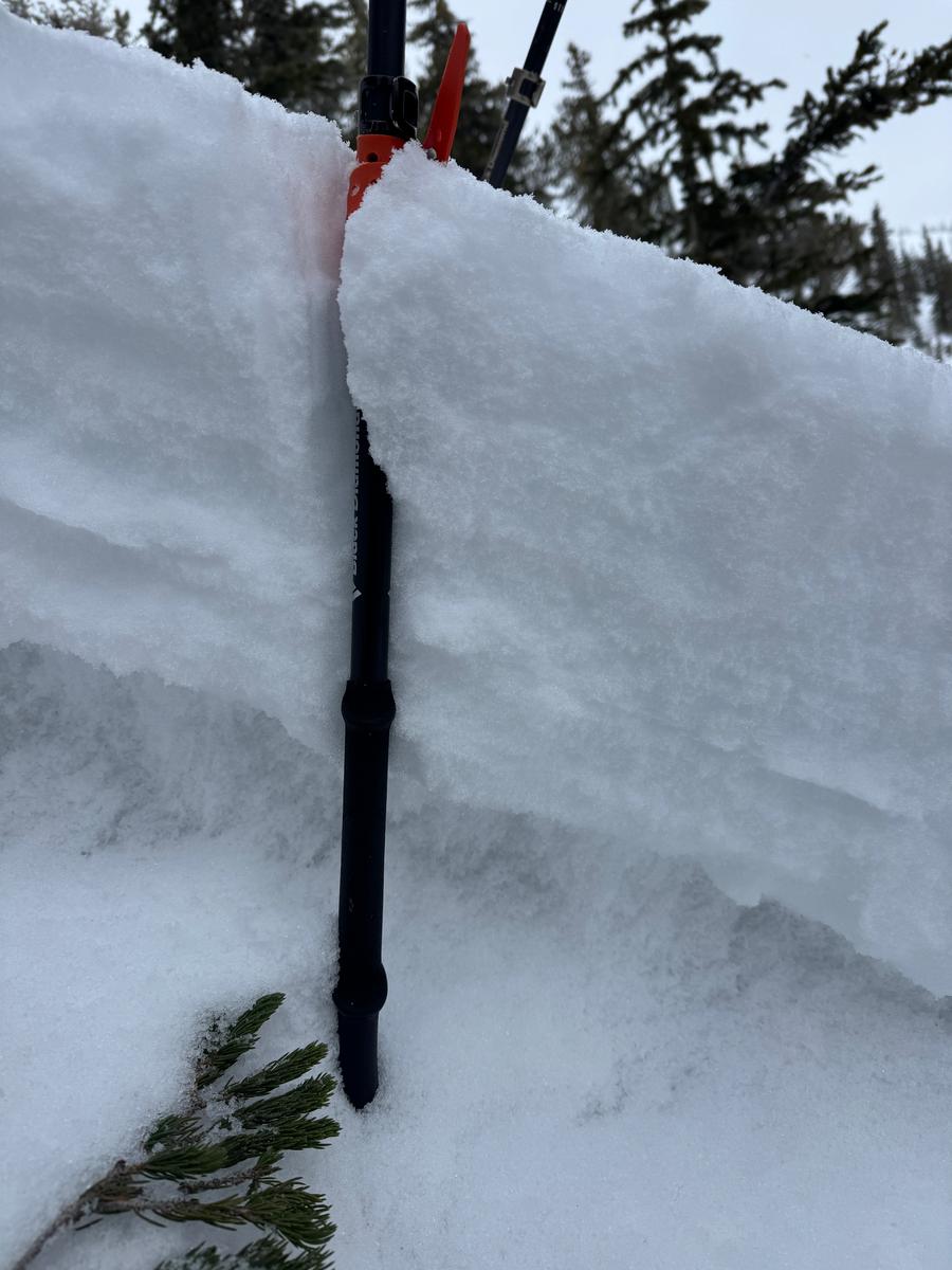
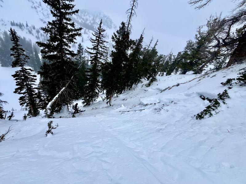
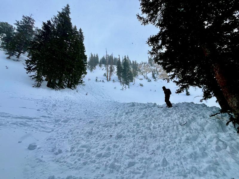
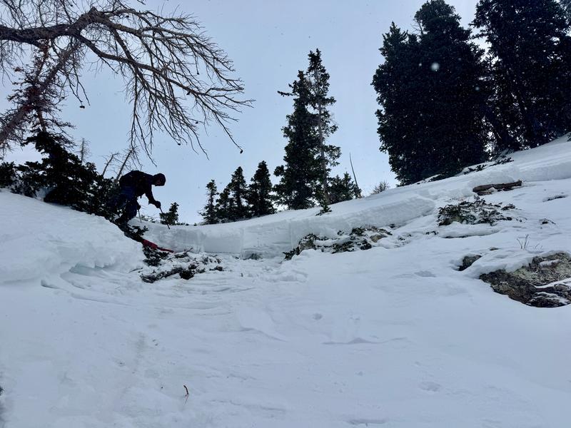
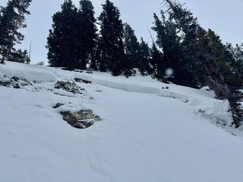
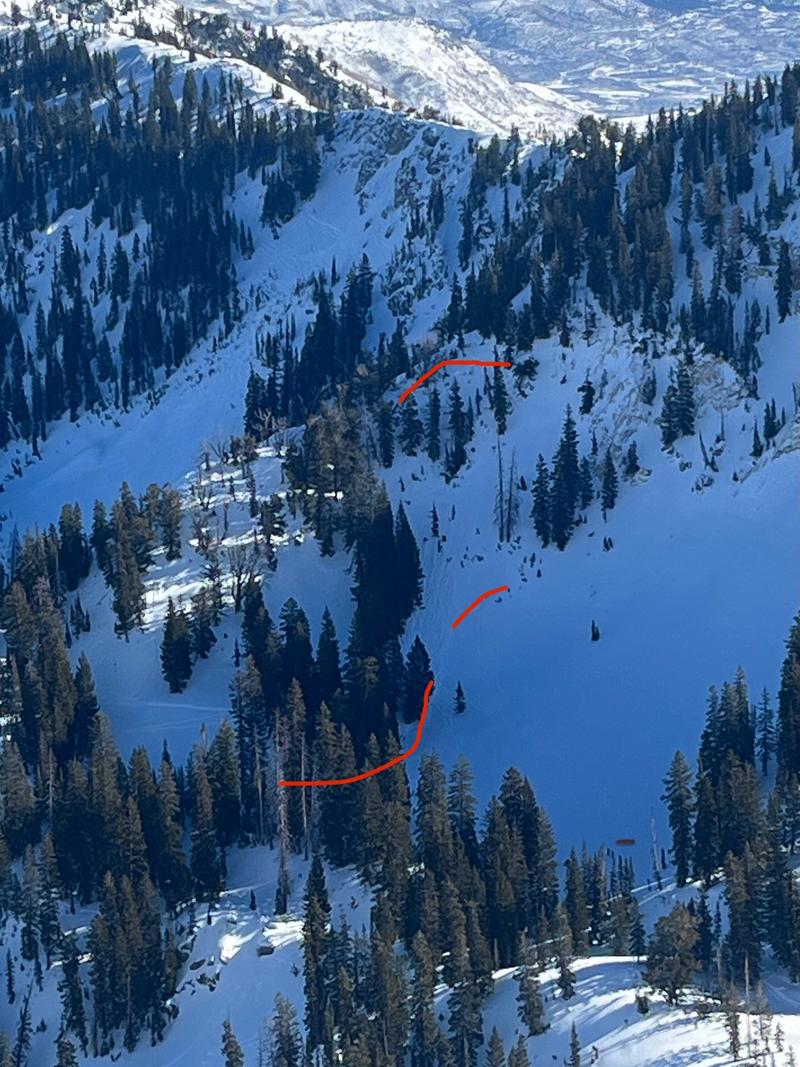
Today, we went to look at a skier triggered avalanche from Thursday January 16, 2025. This avalanche failed on weak facets (depth hoar) near the ground. The avalanche was approximately 2' deep x 75' wide and ran 350' vertical feet to the toe of the debris. The facets near the ground were well established 3-6mm depth hoar (see photo 3 of depth hoar on glove). When doing a snow profile in the crown face we had failure with propagation with isolation (ECTPV@44cm) and failure with propagation at 13 taps (ECTP13@44cm). This particular slope was steep, faced the northern part of the compass and was thin and rocky (see profile photo above).
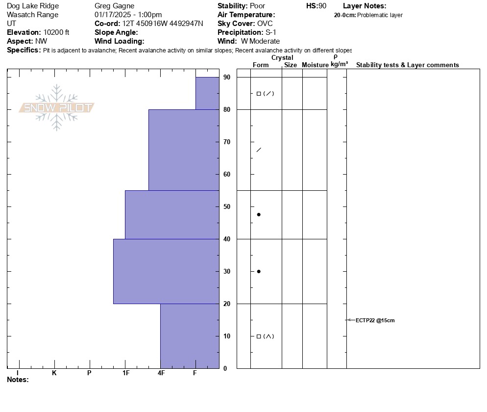
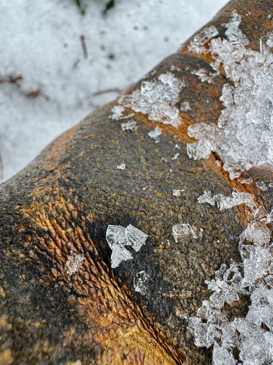
Our snowpack temperatures showed us a very cold snowpack with high temperature gradient. Best guess is that this was a repeater(already avalanched this season) slope based on how thin the snowpack was. While approaching the avalanche crown we dug a hand pit on a northwest slope (330°) at 10,370' (photo 1 below) that showed a total depth of 18" with an intact melt freeze crust 6" from the surface and dry facets near the ground. We also dug a snowpit approximately 100' vertical above the crown face and found weak 4f hard facets near the ground (profile photo 2 below).


Photos below Captions:
Photo 1- Looking up at the crown face (N. Grainger)
Photo 2- Looking down the bed surface at debris piled into trees mid slope (N. Grainger)
Photo 3- Looking up at the avalanche path from the debris pile (N. Grainger)
Photo 4- Looking up at the crown face with crown profile in the background (skier for perspective)
Photo 5- Skiers left side of the crown face
Photo 6- View from Tuscarorara Ridge on January 16, 2025 (J.Kelly)
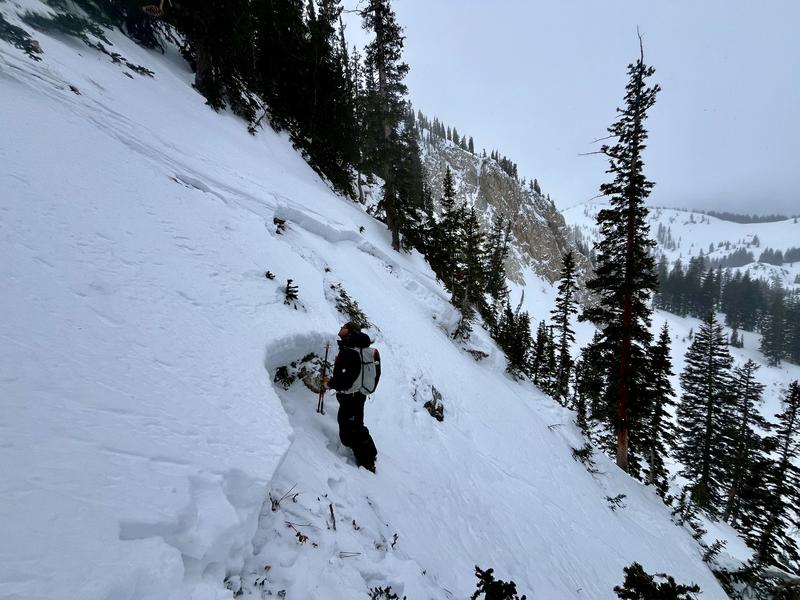
We discussed the travel hazard for today and that that the danger was solid Moderate and that we weren't going to see natural activity, but had the potential to see some human triggered avalanches in a thin, rocky, repeater style zone on mid and upper elevations facing west-north-east.
Today's Observed Danger Rating
Moderate
Tomorrows Estimated Danger Rating
Moderate
Coordinates


